Washington state offers an unparalleled landscape for outdoor enthusiasts, boasting thousands of miles of trails leading to breathtaking destinations. While day hikes provide a glimpse, embarking on an overnight adventure allows you to truly immerse yourself in nature’s tranquility. For those seeking this deeper connection, Overnight Backpacking Washington presents incredible opportunities. From serene alpine lakes to panoramic mountain vistas, spending a night under the stars transforms a hike into an unforgettable journey, often rewarding you with spectacular sunrises and sunsets. This guide explores some of the best routes, catering to various skill levels, providing essential details to help you plan your next escape into the wilderness of the Evergreen State.
When the prime summer weather arrives in Washington (typically mid-June through mid-September), the mountains become an irresistible draw for backpackers. These experiences reveal the truly special nature of staying overnight, allowing ample time to absorb the environment fully. By carrying extra weight, you unlock access to peaceful wilderness settings and potentially witness some of the most memorable sunrises and sunsets of your life. Based on numerous trips, here are some top picks for overnight summer backpacking adventures in Washington, ranging in difficulty from easiest to most challenging.
Choosing Your Adventure: Difficulty Levels
Selecting the right trail is crucial for a successful and enjoyable backpacking trip. Factors like total mileage, elevation gain, trail conditions, and personal fitness all play a role. The beauty of backpacking in Washington is the sheer variety available, ensuring there’s a route suitable for every level of experience. Whether you’re strapping on a pack for the first time or are a seasoned thru-hiker, the state’s diverse terrain offers endless possibilities for exploration and connection with nature.
Beginner-Friendly Overnight Backpacking Washington Trails
For those new to carrying an overnight pack, starting with trails that have minimal elevation gain or shorter distances is highly recommended. These options often become snow-free earlier in the year, making them accessible for spring or even year-round adventures in certain conditions. Getting comfortable with your gear and the rhythm of backpacking on a less strenuous route builds confidence for tackling more challenging trips later.
Some excellent entry points into the world of overnight backpacking in Washington are found in lower elevations or on trails specifically known for their gentle gradients. While the trips listed here are generally considered easier relative to the more difficult routes, truly beginner-specific options often feature very little elevation change, ideal for your first few outings. Many coastal routes, for example, offer a fantastic introduction to backpacking with minimal vertical gain.
Top 15+ Ideas for Unforgettable Family Fun Los Angeles
Discover the Best Backpacking in Michigan – Unforgettable Trails & Adventures
Discover the Best Time to Visit Denver – A Seasonal Guide 2025
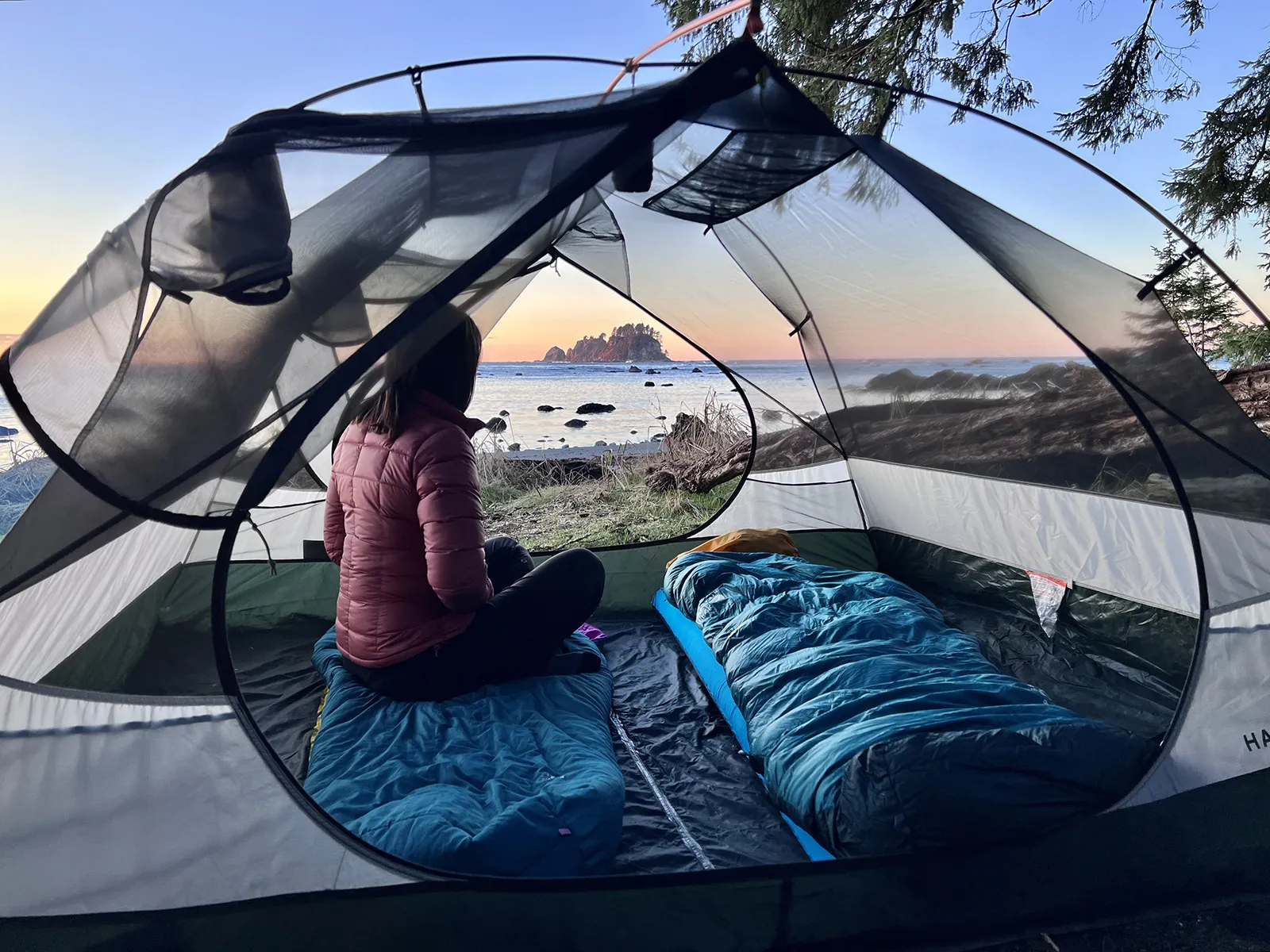 Coastal camping, a gentle start for beginner overnight backpacking Washington
Sheep Lake
- Stats: 3.6 miles roundtrip, 400′ elevation gain
- Area: Mount Rainier area
- Distance from Seattle: 1 hour, 48 min
- Pass/Permit: Northwest Forest Pass
- Dogs Allowed? Dogs allowed on leash
Sheep Lake offers a fantastic, beginner-friendly backpacking experience near Mount Rainier. The trail is gentle, leading to a picturesque lake backed by mountain peaks. Setting up camp at the lake provides a peaceful base. From here, many hikers choose to embark on a day hike the following morning up and over Sourdough Gap to access stunning views of Crystal Lake, adding a bit more adventure without the burden of a full pack.
Skyline Divide
- Stats: 9 miles roundtrip, 2,500′ elevation gain*
- Area: North Cascades, Mount Baker area
- Distance from Seattle: 2 hours, 30 min
- Pass/Permit: Northwest Forest Pass
- Dogs Allowed? Dogs allowed on leash
As of July 2023, road conditions may impact access; check current status before planning.
Skyline Divide in the Mount Baker area of the North Cascades is renowned for its incredible wildflower displays and dramatic sunsets. While the full distance has significant gain, you can establish your campsite after just about 2 miles, tackling the rest of the ridge as a day hike with a lighter load. This strategy makes it surprisingly accessible for beginners. Remember to always camp on established sites to help protect the fragile alpine meadows.
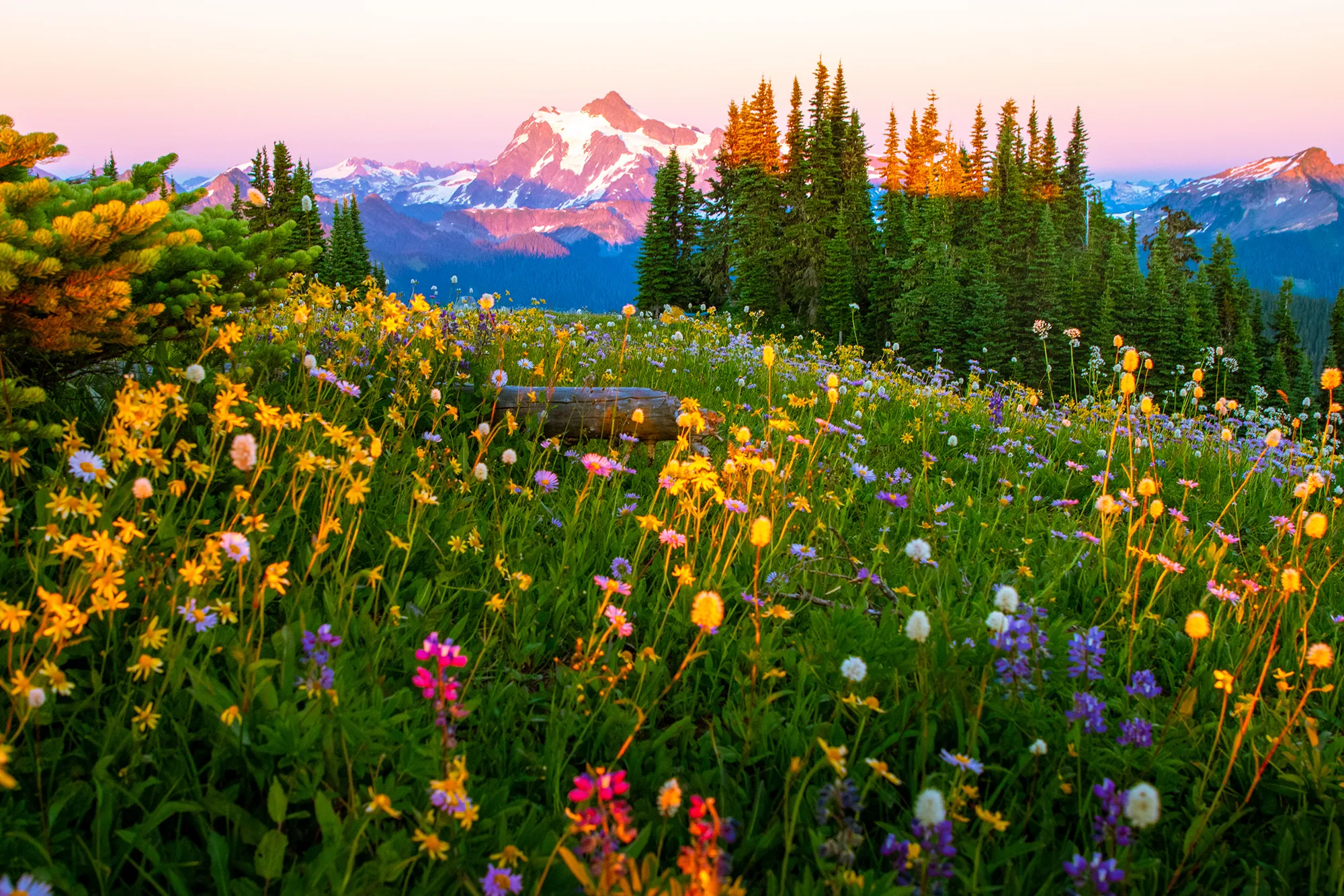 Wildflowers and Mt. Shuksan on the Skyline Divide trail, a popular Washington backpacking route
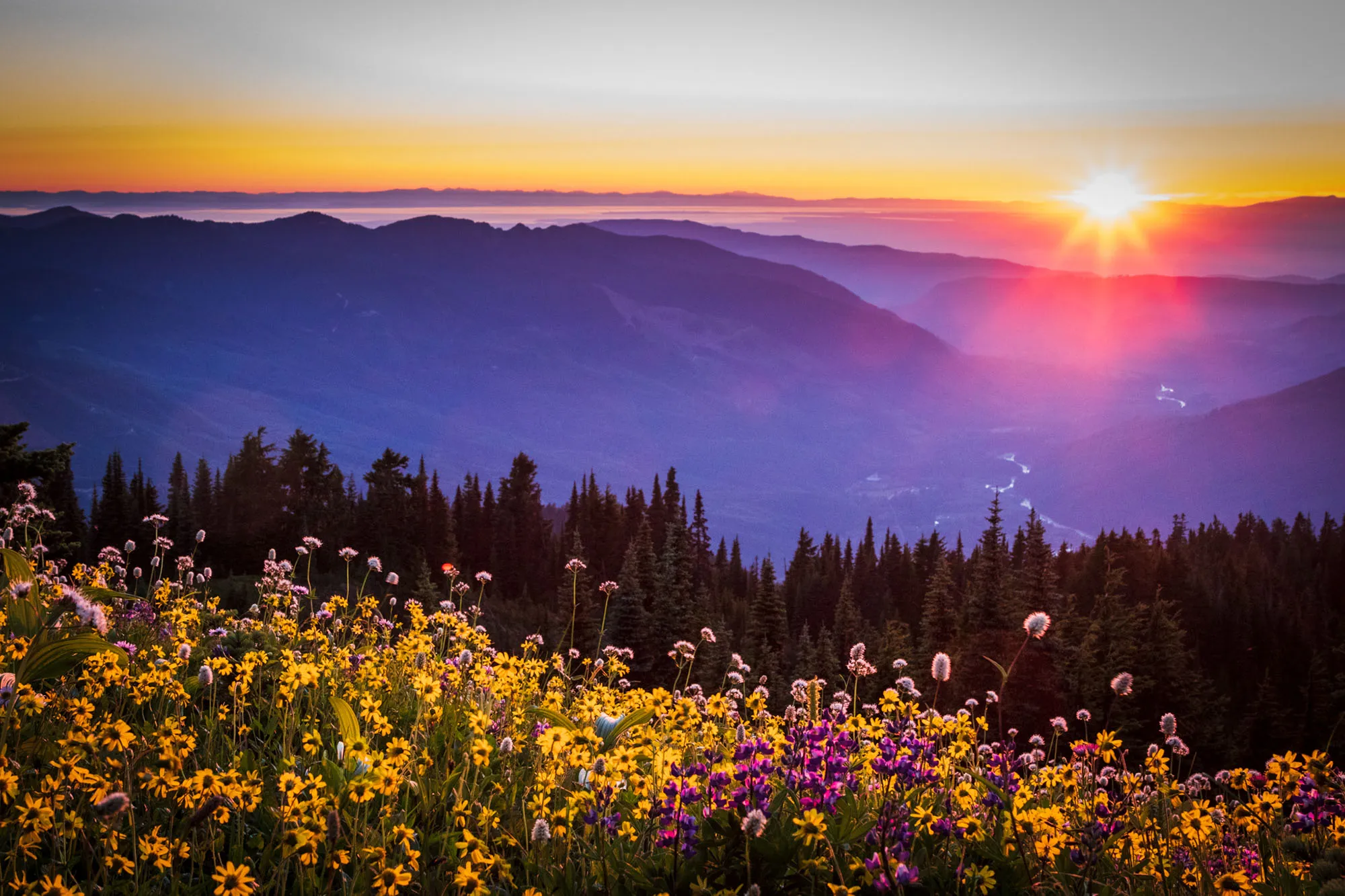 Sunset colors over Skyline Divide during an overnight backpacking trip in Washington
Summit Lake
- Stats: 6.1 miles roundtrip, 1,300′ elevation gain
- Area: Mount Rainier
- Distance from Seattle: 1 hour, 46 min
- Pass/Permit: Northwest Forest Pass
- Dogs Allowed? Dogs allowed on leash
This trail presents beautiful views of deep-blue Summit Lake with the majestic Mount Rainier providing a stunning backdrop. For even more spectacular vistas, consider pushing on to the Summit Lake Ridge. Finding a campsite on the ridge can reward you with unparalleled views. Timing your visit for mid to late July might also allow you to witness a vibrant display of avalanche lilies blooming in a small meadow en route to the ridge from the lake.
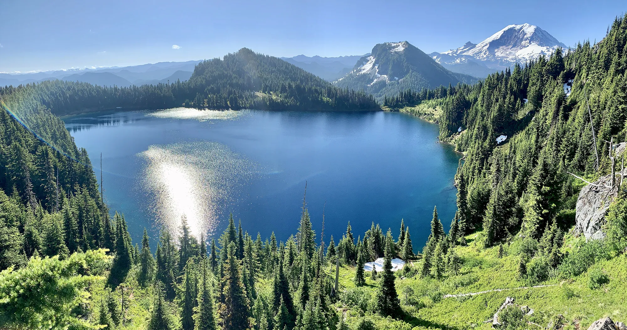 Campsite view from the ridge overlooking Summit Lake in Washington
Tubal Cain Mine to Buckhorn Lake
- Stats: 12 miles roundtrip, 2,000′ elevation gain
- Area: Olympic Peninsula
- Distance from Seattle: 3-3.5 hours
- Pass/Permit: Wilderness permit – self-issue at trailhead (no fee)
- Dogs Allowed? Dogs allowed on leash
Exploring the Tubal Cain Mine trail en route to Buckhorn Lake offers a unique experience, particularly in early July when the first few miles are often surrounded by blooming rhododendrons. The destination is a beautiful turquoise lake. An interesting side trip allows you to explore the remnants of an old plane crash site, adding a touch of history to your natural exploration. This route can also serve as a starting point for longer trips, like extending to Marmot Pass.
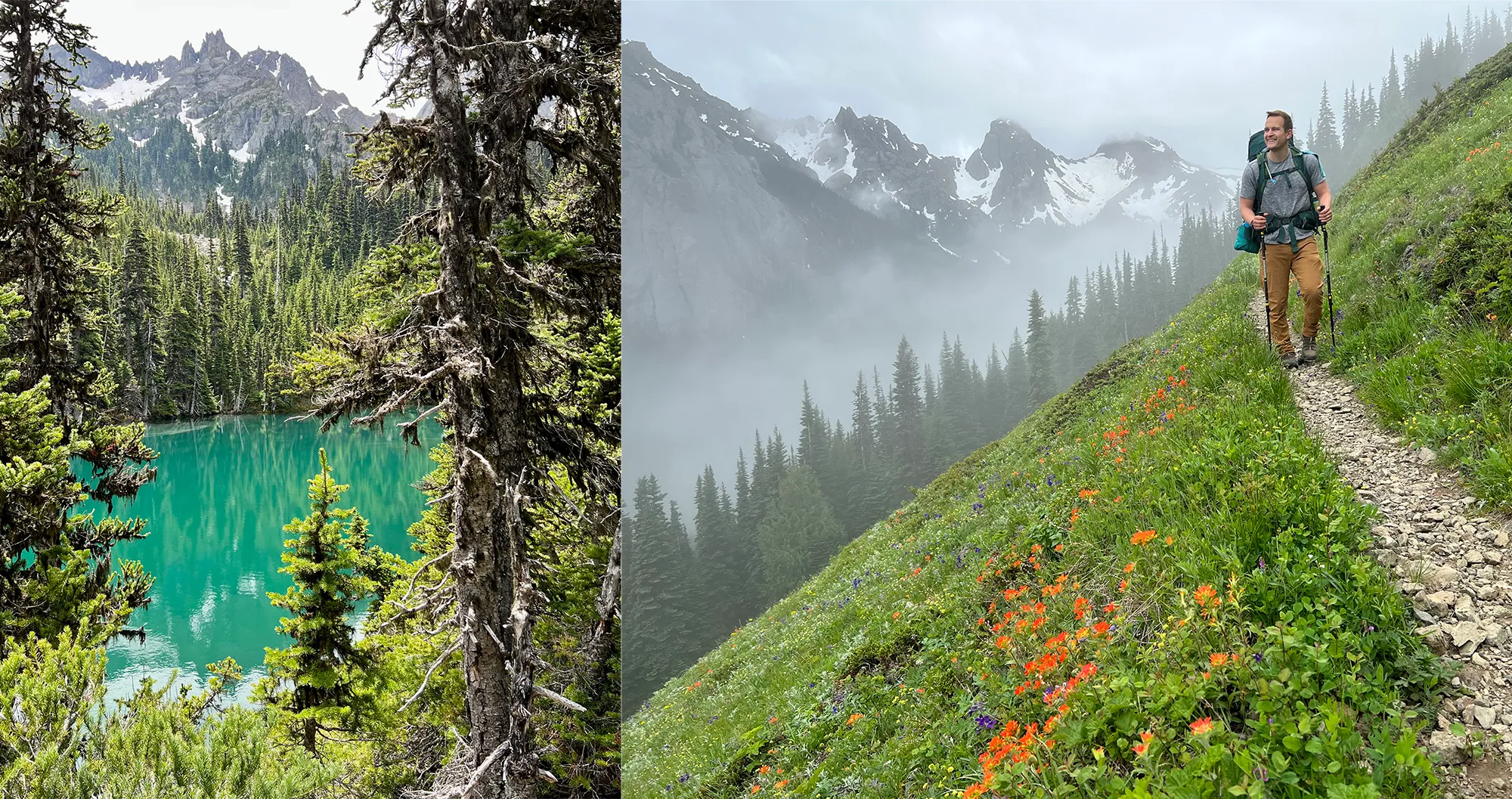 Buckhorn Lake and a moody Pacific Northwest trail scene on the Olympic Peninsula
Park Butte
- Stats: 7.5 miles roundtrip, 2,200′ elevation gain
- Area: North Cascades, Mount Baker area
- Distance from Seattle: 2 hours, 13 min
- Pass/Permit: Northwest Forest Pass
- Dogs Allowed? Dogs allowed on leash
This trail is celebrated for providing expansive views of Mount Baker, the Twin Sisters, and the broader North Cascades landscape as you ascend towards a historic fire lookout. The lookout itself offers a unique potential camping experience; if unoccupied upon your arrival, you may be able to camp inside on a first-come, first-serve basis. The views from the lookout, especially around sunset, are truly breathtaking and a highlight of this trip.
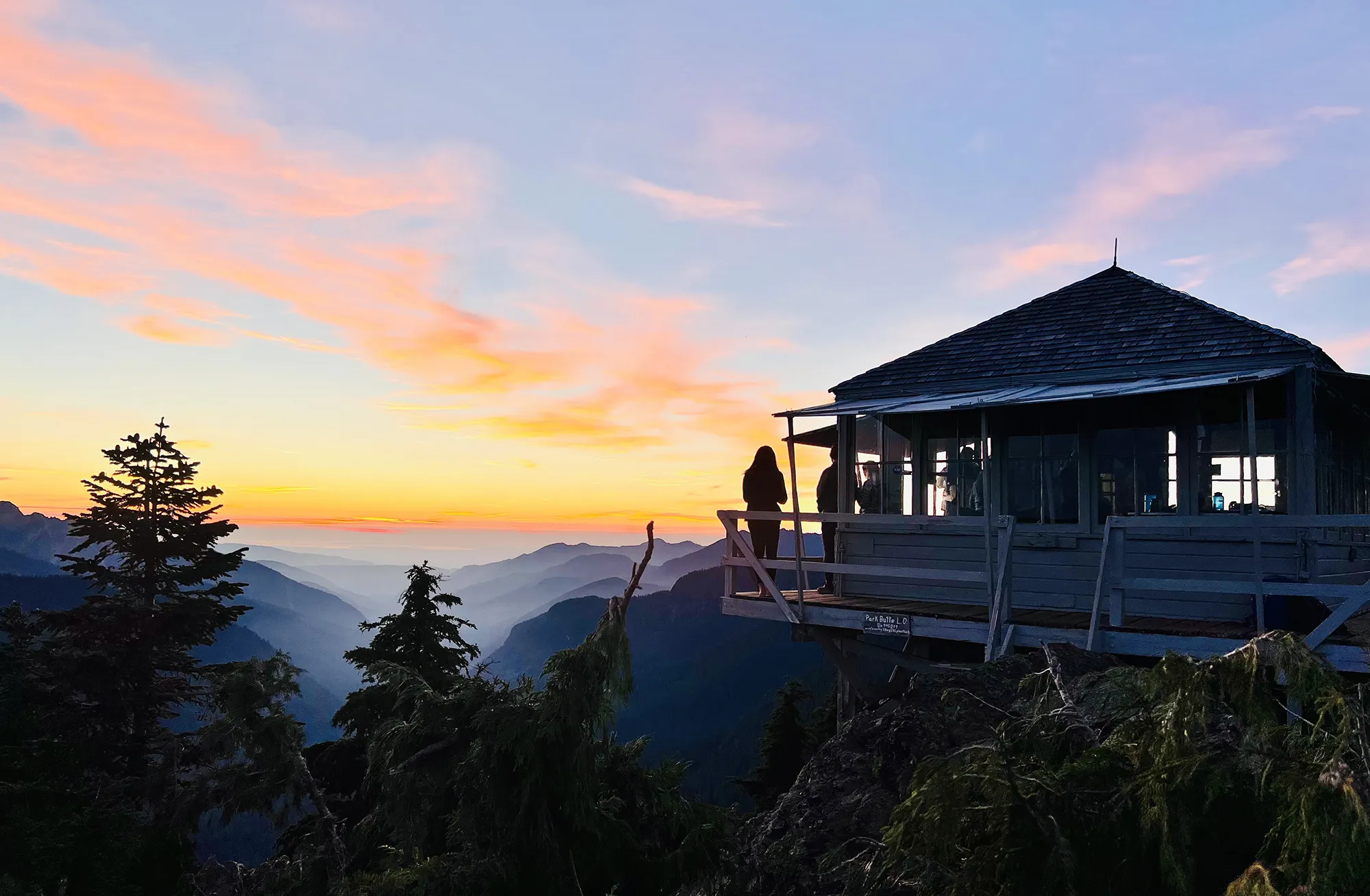 Sunset at the historic Park Butte Fire Lookout during an overnight backpacking trip in Washington
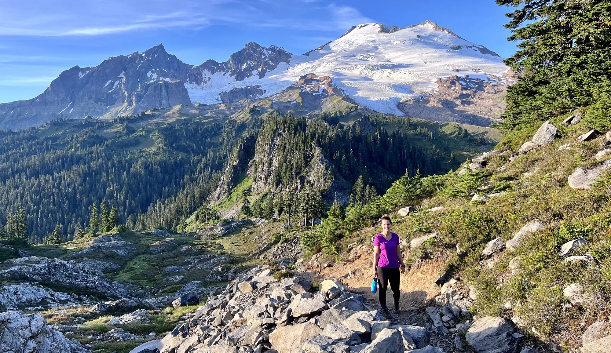 Views of Mount Baker from the trail leading to Park Butte Lookout, Washington
Moderately Challenging Backpacks
Moving into more challenging terrain often means longer distances, greater cumulative elevation gain, or more variable trail conditions. These hikes require a higher level of fitness and experience but reward backpackers with access to more remote and dramatic landscapes. Planning and preparation become even more critical, including understanding navigation, weather patterns, and backcountry ethics.
Lake Ingalls
- Stats: 9 miles roundtrip, 2,500′ elevation gain
- Area: Snoqualmie Region, Salmon La Sac/Teanaway
- Distance from Seattle: 2 hours, 19 min
- Pass/Permit: Northwest Forest Pass
- Dogs Allowed? No dogs allowed
Lake Ingalls is a spectacular destination known for its vibrant blue water and views of Mount Stuart. Camping is not permitted directly by the lake, but Headlight Basin, located about 0.8 miles before the lake, offers numerous campsites with excellent views of Mount Stuart. This area can be prone to wind, so choosing a sheltered site and securing your tent properly is advisable. The trail also provides opportunities to encounter local wildlife, including mountain goats.
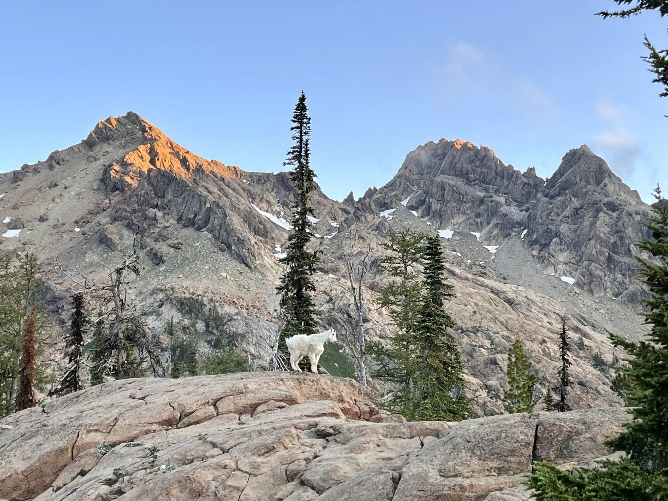 Mountain goat near Lake Ingalls in Washington during a solo backpacking trip
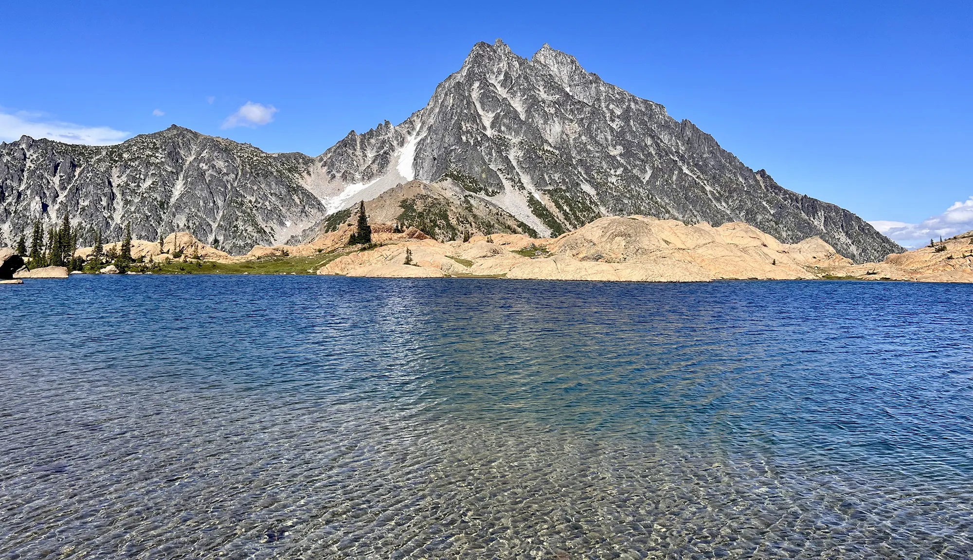 Deep blue Lake Ingalls with Mount Stuart in the background
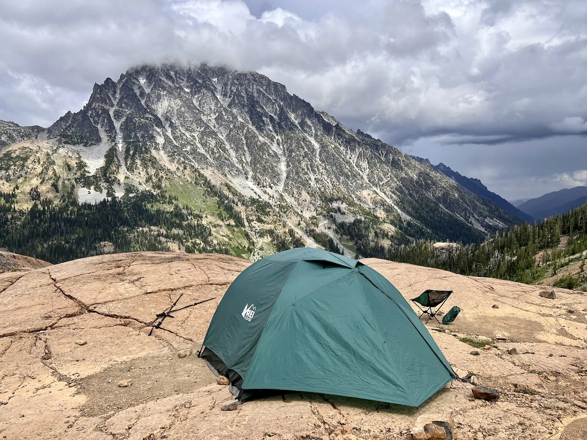 Camping on rocks in Headlight Basin near Lake Ingalls, Washington
Snowgrass Flats and Goat Lake Loop
- Stats: 12.3 miles roundtrip, 2,706′ elevation gain
- Area: South Cascades, Goat Rocks area
- Distance from Seattle: 3 hours
- Pass/Permit: Wilderness permit – self-issue at trailhead (no fee)
- Dogs Allowed? Dogs allowed on leash
This loop trail offers a continuously changing panorama, encompassing everything from expansive views of Mount Adams and fields of wildflowers to a beautiful lake. A highlight for some is the possibility of waking up to a stunning cloud inversion. The lake area can be very windy, so packing extra layers and ensuring your tent is well-staked is important. For the more adventurous, an ascent to Old Snowy Mountain adds significant challenge but promises incredible views.
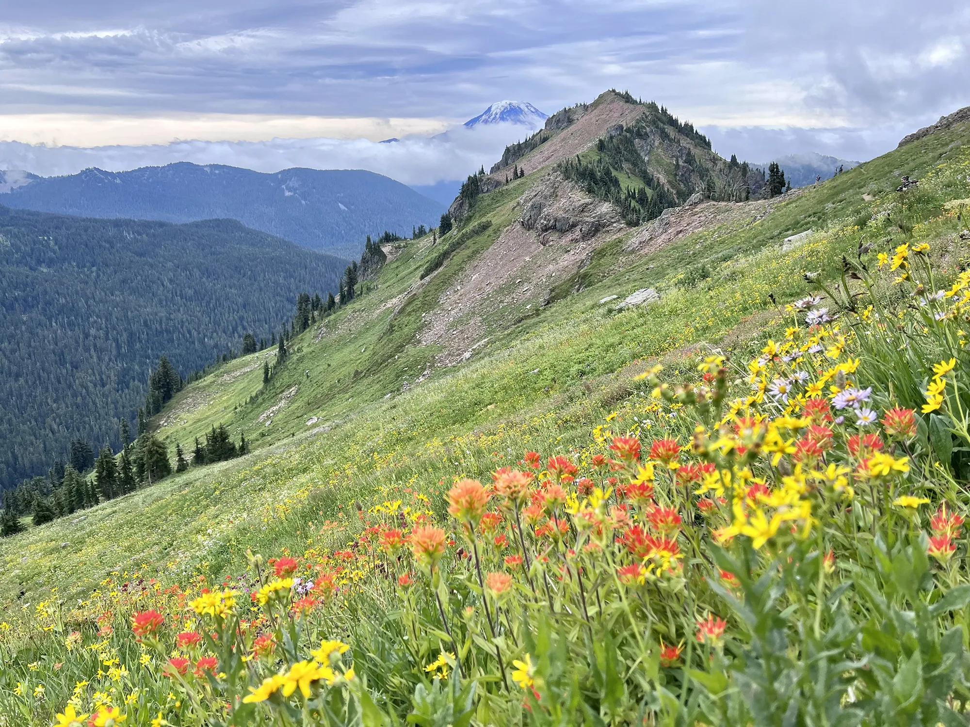 Abundant wildflowers on the Snowgrass Flats trail towards Goat Lake, Washington
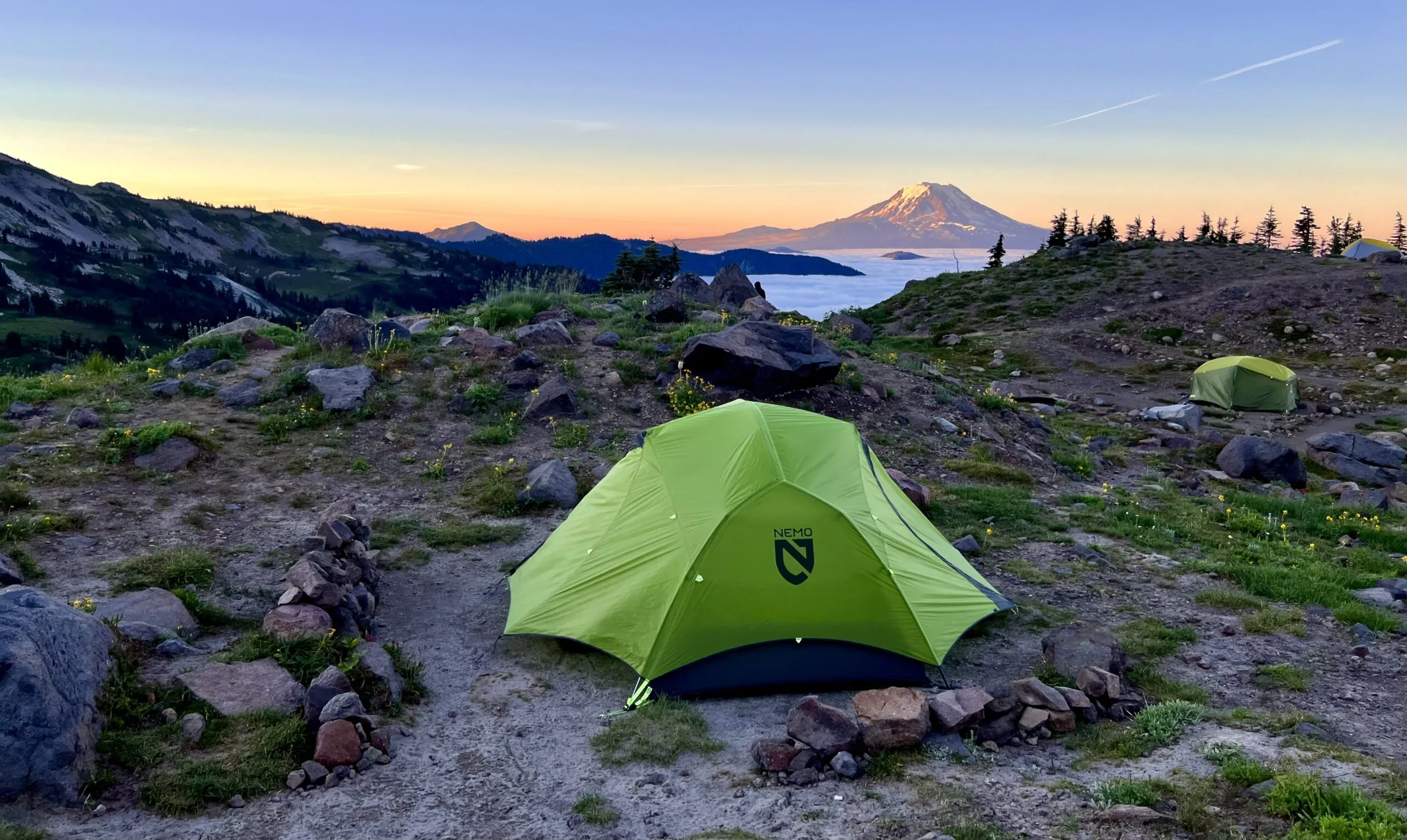 Cloud inversion captured at sunrise near Snowgrass Flats, Washington
Paddy-Go-Easy Pass
- Stats: 6 miles roundtrip, 2,560′ elevation gain
- Area: Snoqualmie Region, Salmon La Sac/Teanaway
- Distance from Seattle: 2 hours, 25 min
- Pass/Permit: Wilderness permit – self-issue at trailhead (no fee)
- Dogs Allowed? Dogs allowed on leash
Despite its relatively shorter distance, this hike presents a significant challenge due to its elevation gain. However, the effort is richly rewarded with a sense of solitude and beautiful scenery, including views of the gorgeous Sprite Lake and glimpses of Mount Daniel. An interesting, though somewhat hidden, feature is the remnant of a small old mine shaft on the southwest ridge – approach with caution as it’s primarily just a large hole now.
![]() Overlooking Sprite Lake from the ridge near Paddy-Go-Easy Pass, Washington
Overlooking Sprite Lake from the ridge near Paddy-Go-Easy Pass, Washington
Navaho Peak
- Stats: 13.7 miles roundtrip, 4,223′ elevation gain
- Area: Snoqualmie Region, Salmon La Sac/Teanaway
- Distance from Seattle: 1 hour, 58 min
- Pass/Permit: Northwest Forest Pass
- Dogs Allowed? Dogs allowed on leash
The statistics for Navaho Peak might seem daunting, but a strategic approach can make it manageable. Setting up camp in the meadow area below Navaho Pass allows you to tackle the final push to the peak the next day with a lighter day pack. While the ascent to the summit is demanding, the payoff is a breathtaking 360-degree panorama. The area also offers stunning sunset views of the nearby Mount Stuart range.
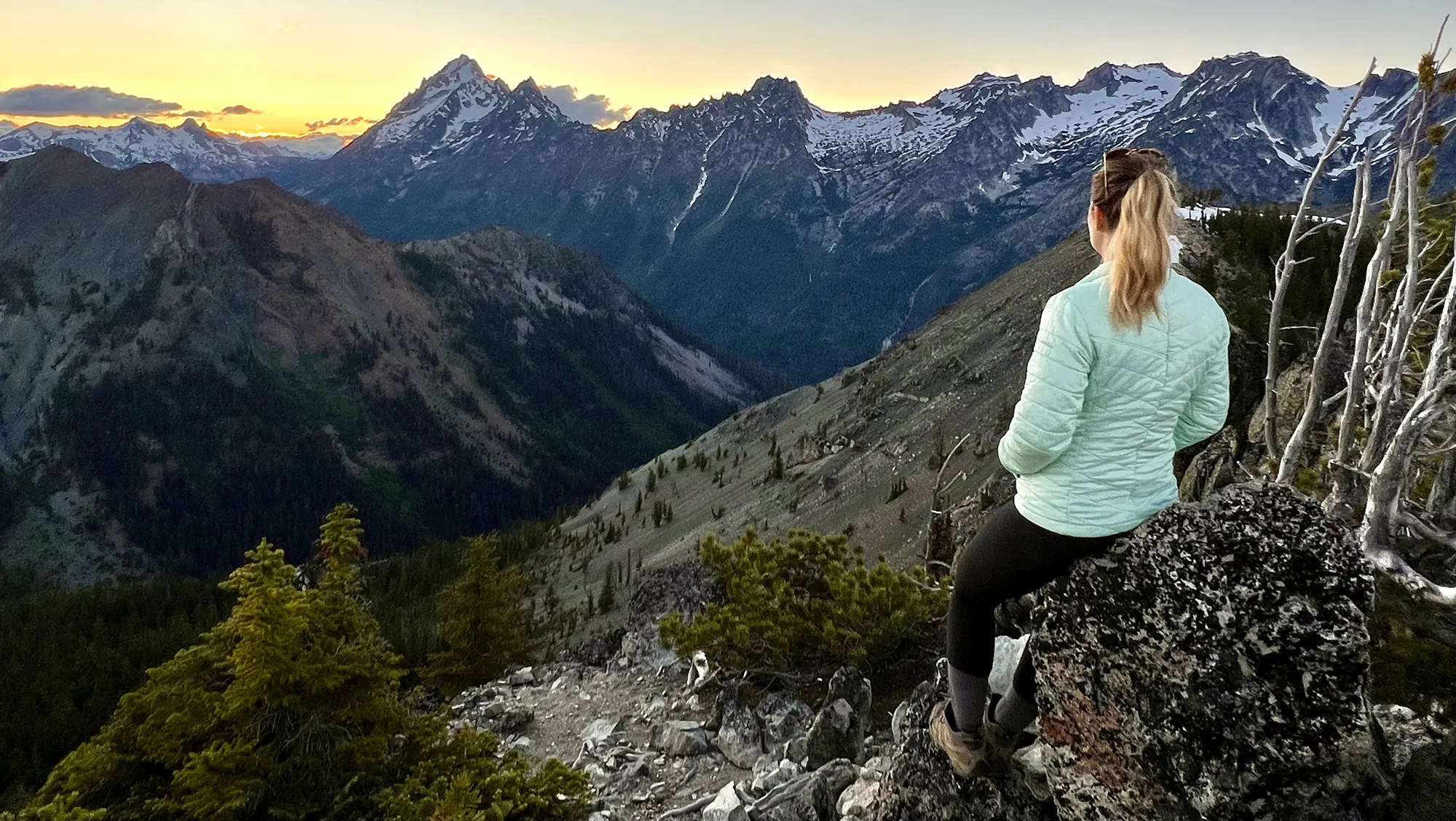 Sunset views of the Mount Stuart range from near Navaho Peak, Washington
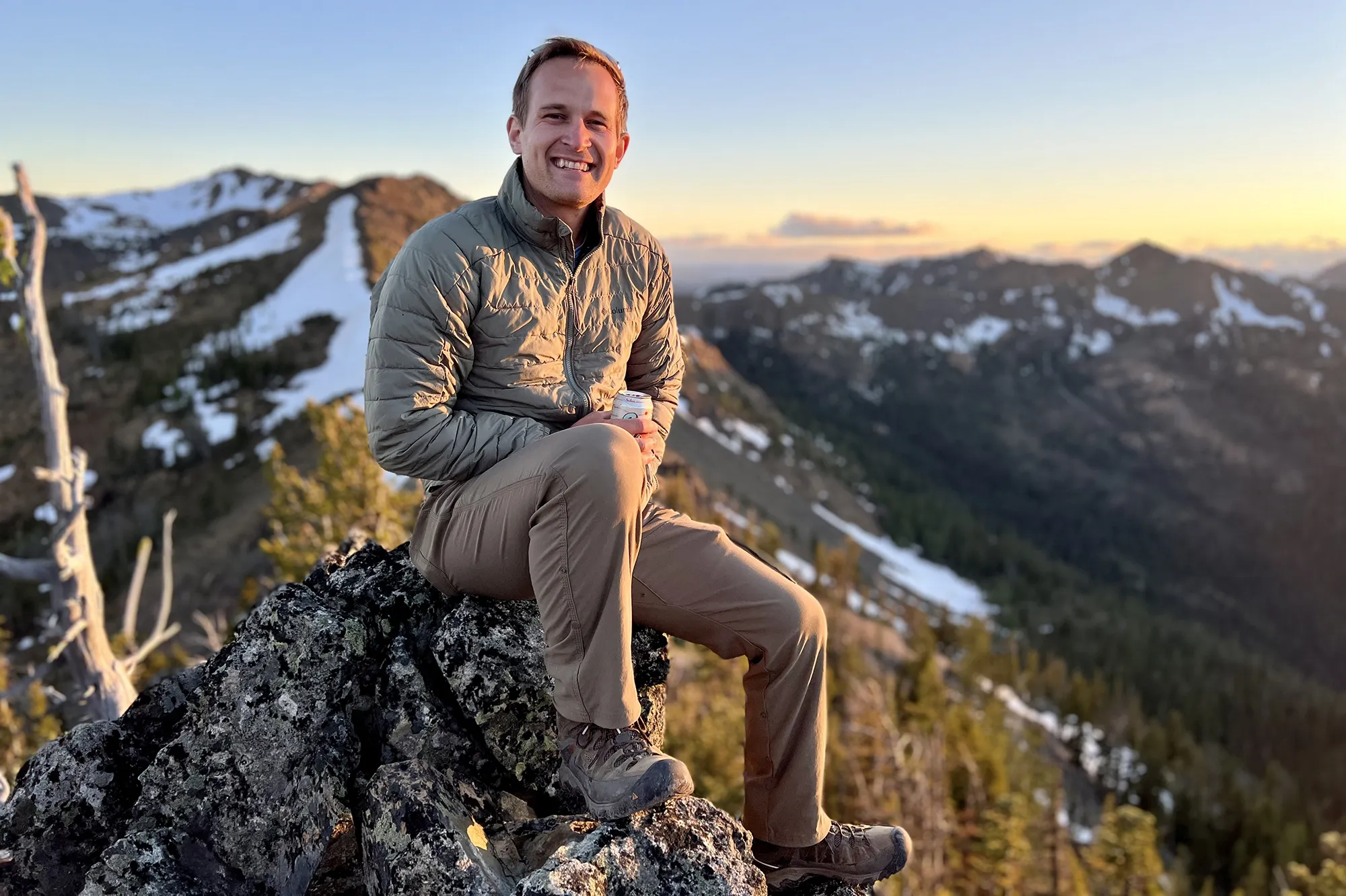 Panoramic view from Navaho Peak after a challenging overnight backpacking trip in Washington
Rachel & Rampart Lakes
- Stats: 9 miles roundtrip, 2,539′ elevation gain
- Area: Snoqualmie Pass
- Distance from Seattle: 1 hour, 23 min
- Pass/Permit: Northwest Forest Pass
- Dogs Allowed? Dogs allowed on leash
This trail is deceptively challenging, with a significant portion of the elevation gain concentrated over a short distance after an initial flat section. The path itself can be wet, rocky, and root-filled, demanding careful footing. However, both Rachel and Rampart Lakes are exceptionally beautiful. While Rachel Lake makes for a pleasant stop, continuing the steep but relatively short distance to Rampart Lakes offers more camping options and arguably superior views, making the extra effort worthwhile.
Demanding Overnight Backpacking Washington Routes
These routes are intended for experienced backpackers who are comfortable with significant elevation gain, longer distances, rugged terrain, and potentially more complex navigation. They demand physical stamina, mental resilience, and a solid understanding of backcountry safety and preparedness. The rewards, however, are often unparalleled solitude, dramatic vistas, and a profound sense of accomplishment.
Marmot Pass via Upper Big Quilcene Trail
- Stats: 11.5 miles roundtrip, 3,489′ elevation gain
- Area: Olympic Peninsula
- Distance from Seattle: 2 hour, 30 min
- Pass/Permit: Northwest Forest Pass
- Dogs Allowed? Dogs allowed on leash
This backpack presents a substantial challenge, potentially feeling more difficult than the statistics suggest. One common strategy is to establish a camp lower down, such as at Camp Mystery, and then hike up to Marmot Pass for sunrise, which can be an absolutely incredible experience. The views from the pass at dawn are often cited as a highlight. As with any alpine environment, it’s crucial to set up your tent only on established sites to protect sensitive meadows and wildflowers.
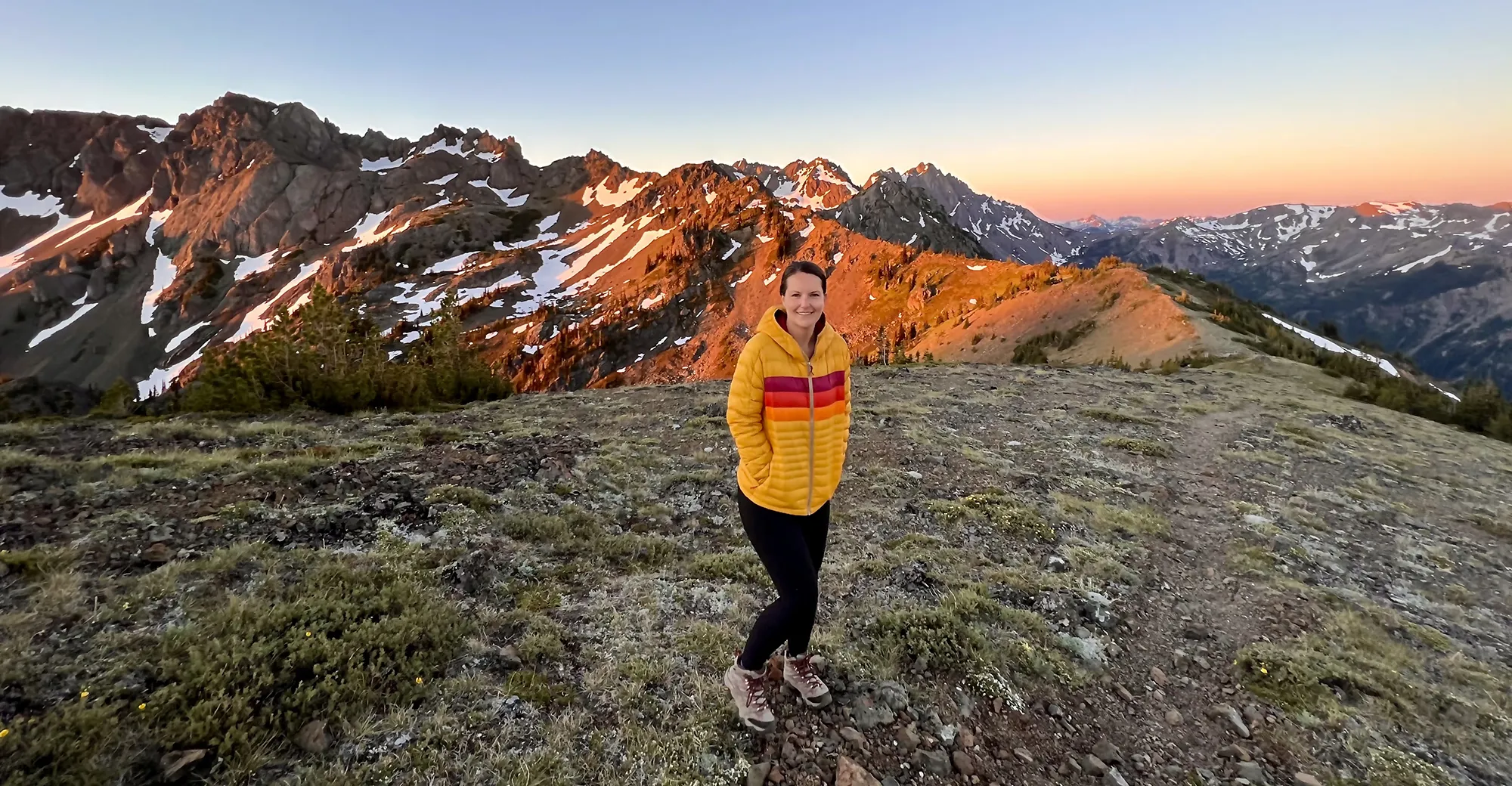 Sunrise on the ridge just to the left of Marmot Pass
Surprise Lake to Thunder Mountain Lakes
- Stats: 14.5 miles roundtrip, 4,287′ elevation gain
- Area: Stevens Pass
- Distance from Seattle: 1 hour, 30 min
- Pass/Permit: Northwest Forest Pass
- Dogs Allowed? Dogs allowed on leash
This is a long and strenuous hike, but the chain of gorgeous lakes along the way justifies the effort. One popular approach is to make it a multi-night trip, perhaps camping at Surprise Lake on the first night, then continuing to Thunder Mountain Lakes for the second night, and hiking out on the third day. The connector trail between Surprise Lake and Thunder Mountain Lakes involves a lengthy series of switchbacks but is generally easy to follow.
Beyond Trap Pass, there are steep sections and short boulder fields, but the views of Trap Lake and the destination lakes are spectacular. Camping at Thunder Mountain Lakes can be limited and often on rocky ground, so securing your shelter against potential wind is important.
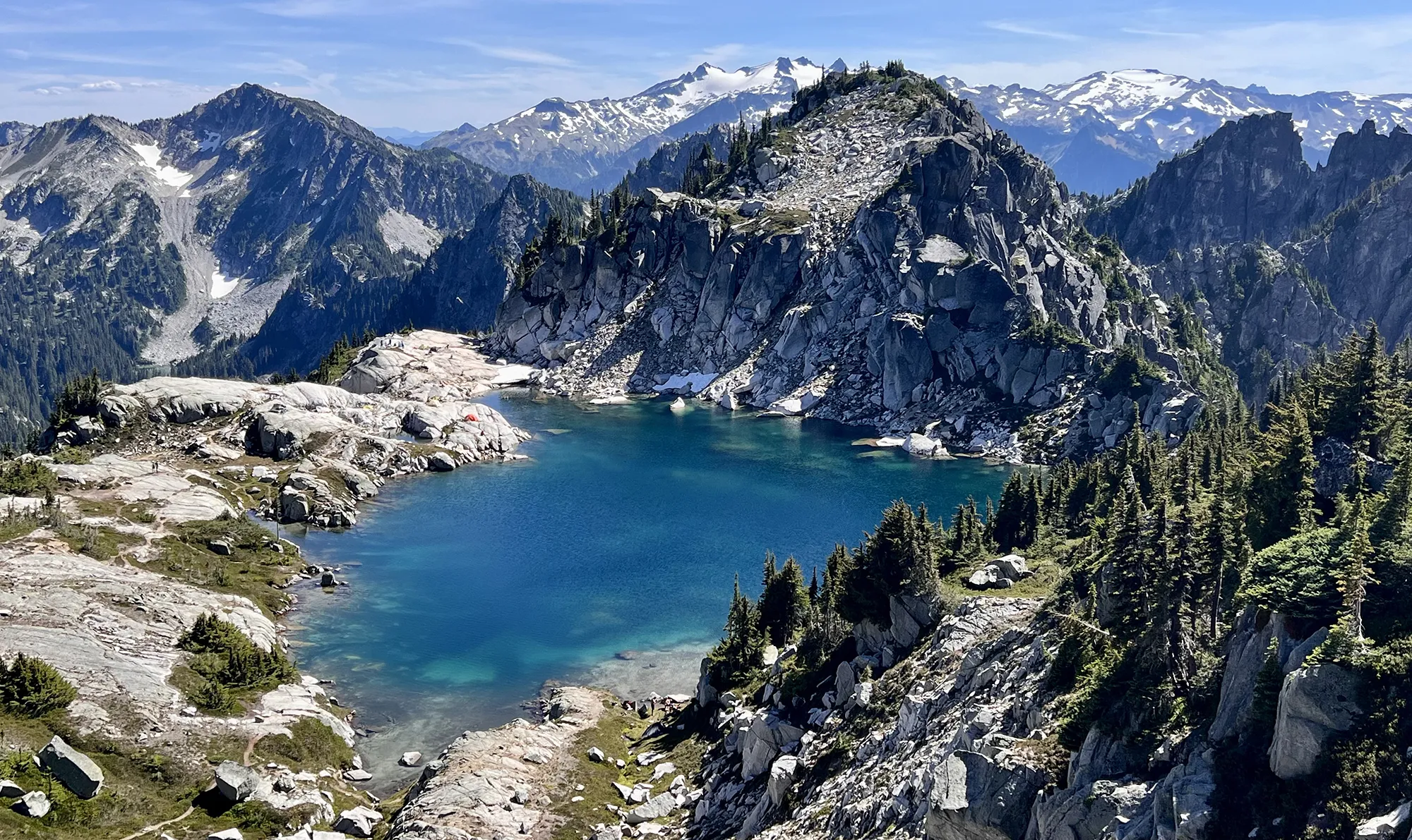 Looking down on Thunder Mountain Lake from a nearby ridge, Washington
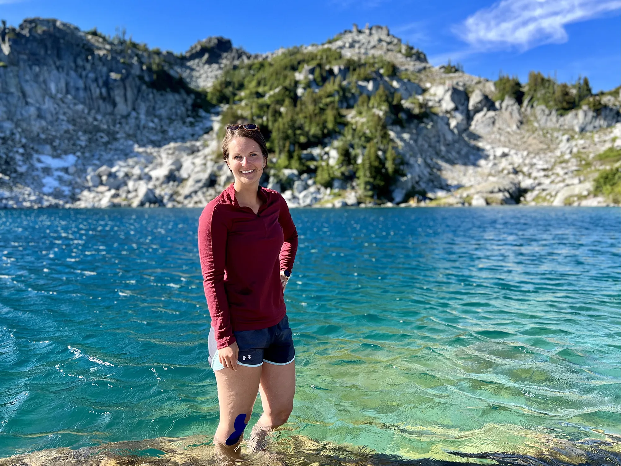 Enjoying a dip in Thunder Mountain Lake after a long hike, Washington
Lewis and Wing Lakes
- Stats: 12 miles roundtrip, 2,652′ elevation gain
- Area: North Cascades
- Distance from Seattle: 3 hours
- Pass/Permit: Northwest Forest Pass
- Dogs Allowed? Dogs allowed on leash
Lewis and Wing Lakes is a highly sought-after backpacking destination, particularly in the fall when the golden larches are in full splendor. The trail initially shares a path with the popular Heather – Maple Pass Loop for about two miles, so planning for potentially crowded parking is necessary, especially on weekends. The turn-off to Lewis and Wing Lakes can be subtle, requiring attention to navigation. A significant boulder field stretch adds challenge before reaching the stunning turquoise Lewis Lake.
The climb between Lewis and Wing Lakes is tough but offers incredible views back down. For the truly ambitious, a strenuous scramble up scree slopes leads to Black Peak (8291 ft) for commanding views over the lakes below (a helmet is strongly recommended for this section).
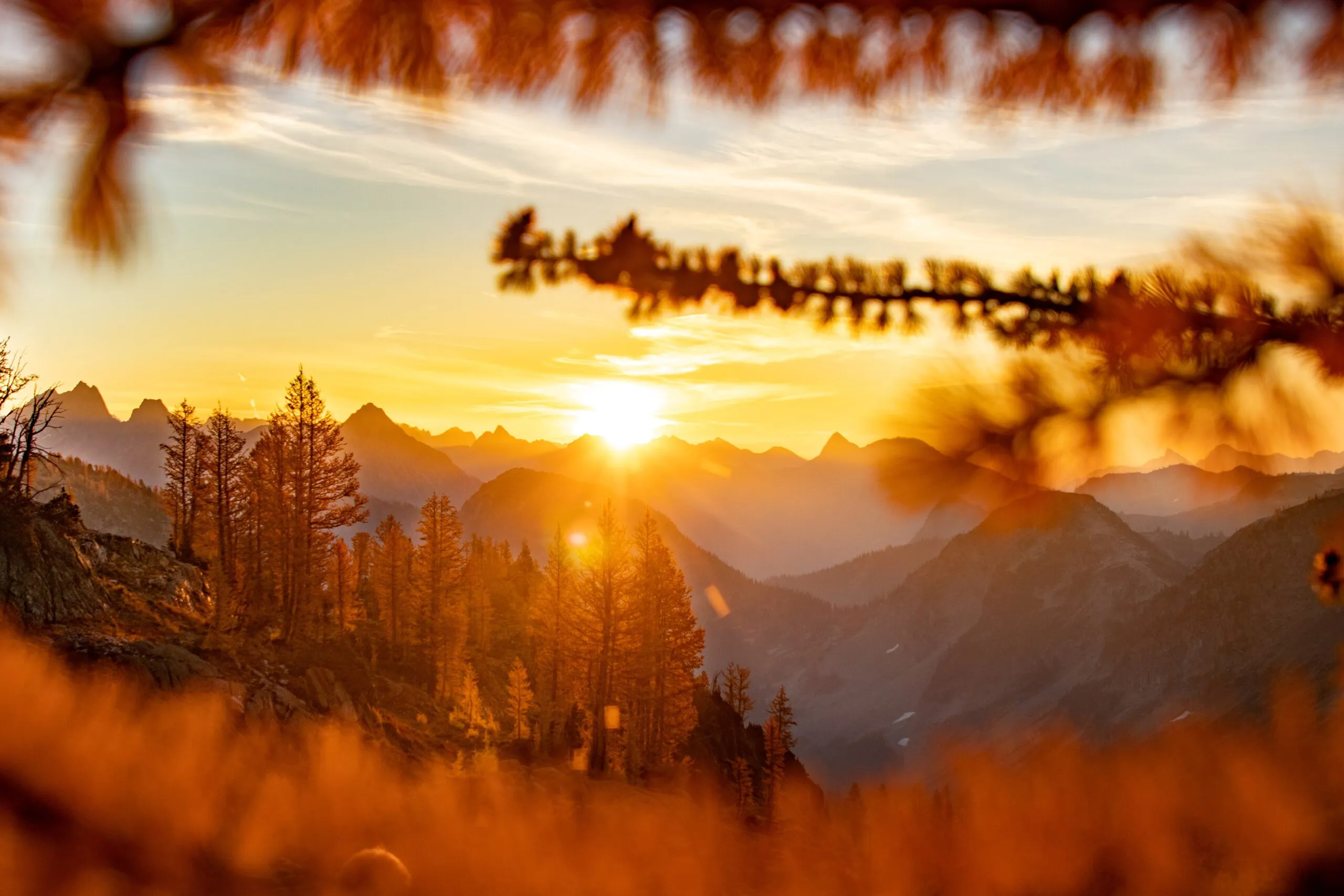 Sunrise over the North Cascades near Lewis and Wing Lakes, Washington
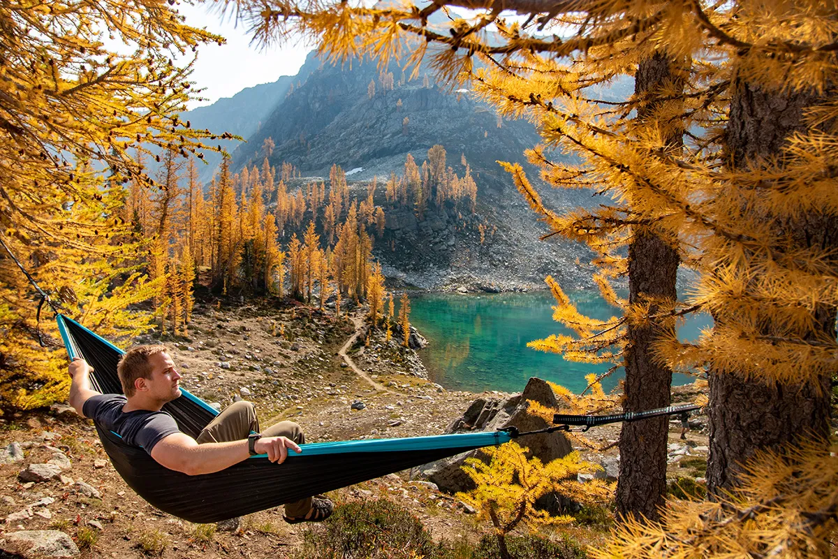 Hammock view overlooking Wing Lake on an overnight backpacking trip in Washington
Tuck & Robin Lakes
- Stats: 11.96 miles roundtrip, 3,354′ elevation gain
- Area: Snoqualmie Region, Salmon La Sac/Teanaway
- Distance from Seattle: 2 hours, 30 min
- Pass/Permit: Northwest Forest Pass
- Dogs Allowed? Dogs allowed on leash
While the initial 3.5 miles of this trail are relatively flat, the subsequent ascent to Tuck and then the very steep push to Robin Lakes are extremely challenging, making the stats somewhat misleading. This route is often cited as demanding due to the concentrated elevation gain. It requires significant physical preparation, particularly for carrying a full pack. Despite the difficulty, the scenery around both Tuck and Robin Lakes is absolutely gorgeous, featuring stunning alpine pools nestled in dramatic terrain, offering truly memorable camp views.
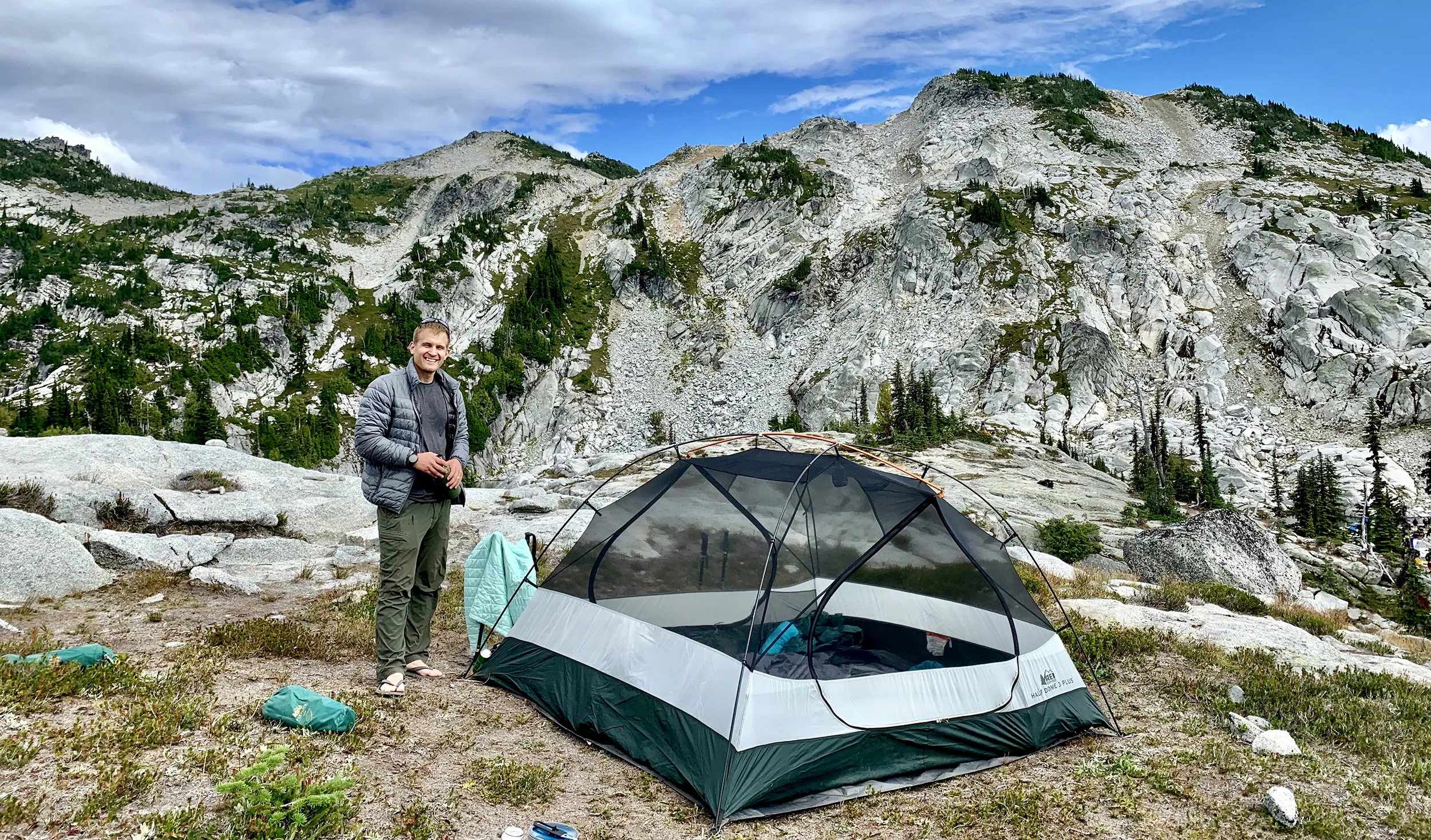 Campsite view overlooking Robin Lakes during an overnight backpacking Washington trip
Frequently Asked Questions About Overnight Backpacking Washington
Planning an overnight backpacking trip involves understanding specific requirements and conditions. Here are answers to some common questions.
What permits are required for backpacking in Washington?
Permit requirements vary depending on the specific trail and land management agency. Many trails in national forests require a Northwest Forest Pass for parking at the trailhead. Wilderness areas often require a self-issued permit available at the trailhead, which helps land managers track usage. Popular areas, especially within national parks, may require advanced reservations or lottery systems for backcountry permits. Always check the regulations for your chosen trail before heading out.
Are dogs allowed on these trails?
Dog regulations differ between trails and land designations in Washington. Generally, dogs are allowed on trails in national forests and wilderness areas, often required to be on a leash. However, national parks typically have stricter rules, often prohibiting dogs on most hiking trails beyond developed areas. Each trail listing above indicates whether dogs are allowed based on current information, but it is crucial to verify this with the managing agency before bringing your dog.
What is the best time of year for overnight backpacking in Washington?
The prime season for high-elevation backpacking in Washington is typically from mid-June through mid-September, when trails are most likely to be free of significant snow. However, lower elevation and coastal trails can be accessible much earlier or even year-round. Shoulder seasons (spring and fall) can offer beautiful conditions with fewer crowds, though you should be prepared for more variable weather, including snow at higher elevations.
Conclusion
Embarking on an overnight backpacking journey in Washington is an experience that connects you deeply with the state’s stunning natural beauty. From the gentle slopes leading to serene alpine lakes to the challenging ascents offering panoramic summit views, there is a trail suited to every level of ambition and experience. These trips not only test your physical limits but also provide moments of quiet reflection, unforgettable sunrises and sunsets, and a profound appreciation for the wild landscapes of the Pacific Northwest. As you plan your adventure, remember to research current conditions, obtain necessary permits, practice Leave No Trace principles, and choose a route that aligns with your skills and preparation. The trails are waiting.
