Wyoming, often called the “Equality State,” is a land of stunning contrasts, from its majestic mountain ranges to its vast, high plains. Its diverse topography profoundly influences the Climate In Wyoming Usa, creating a unique environment that shapes landscapes, ecosystems, and human life. For anyone planning a visit or simply curious about this corner of the United States, understanding the local climate is key to appreciating its rugged beauty and planning unforgettable experiences. As a travel expert, I can tell you that Wyoming’s weather isn’t just background noise; it’s a vital character in the story of your journey here.
The mean elevation across Wyoming is approximately 6,700 feet above sea level. Even outside the prominent mountain ranges, the southern part of the state sits well over 6,000 feet, while the northern regions are significantly lower, sometimes by as much as 2,500 feet. This dramatic variation in altitude is a primary driver of Wyoming’s complex climate patterns. The lowest point, 3,125 feet, is found near the northeast corner where the Belle Fourche River crosses into South Dakota. On the other end of the spectrum, Gannett Peak, part of the Wind River Range in west-central Wyoming, soars to 13,785 feet.
These north-south trending mountain ranges act as natural barriers to the prevailing westerlies, air currents moving in from the Pacific Ocean. As this moisture-laden air is forced upwards by the mountains, it cools and releases much of its precipitation on the western slopes. This rain shadow effect leaves the regions east of the mountains significantly drier, classifying much of the state as semi-arid. Despite the fame of its peaks, mountains cover less area than the high plains, adding to the climatological complexity. Dividing the state into simple, uniform climate zones is challenging due to these varied elevational and topographical features.
Discover the Best – Where to Go on Vacation in Florida
Your Ultimate Guide – what to eat in destin florida
Discover Fun Things to Do in LA Today
 Mountain peaks in the Wind River Range, Wyoming, illustrating high altitude Climate In Wyoming Usa
The Continental Divide cuts through Wyoming from the northwest corner down to the center of the southern border. This division dictates the flow of water, sending most drainage areas eastward. The state’s runoff feeds into three major river systems: the Columbia, the Colorado, and the Missouri. The Snake River in the northwest contributes to the Columbia. The Green River drains the southwest and flows into the Colorado River system.
The Yellowstone, Wind River, Big Horn, Tongue, and Powder rivers cover much of the northern drainage, flowing north towards the Missouri. In the east-central part, the Belle Fourche, Cheyenne, and Niobrara rivers flow eastward, while the Platte drains the southeast into Nebraska. A smaller area along the southwest border drains via the Bear River into the Great Salt Lake. This intricate network of rivers and drainage basins is profoundly impacted by the state’s climate patterns, especially precipitation and snowmelt.
Understanding the Climate In Wyoming Usa – Essential Guide for Travelers
A unique geological feature is the Great Divide Basin in the south-central portion, west of Rawlins. This area, sometimes called the Red Desert, has no external drainage. Annual precipitation, averaging a mere 7 to 10 inches, collects in temporary ponds or small lakes, where it either evaporates or soaks into the ground. This lack of drainage highlights the aridity of certain parts of the state, even at relatively high elevations, a key characteristic of the Climate In Wyoming Usa.
Considerable depths of snow accumulate in the high mountains, serving as vital reservoirs. The melting snowpack in spring and summer feeds numerous streams, providing essential water for irrigating thousands of acres, generating hydroelectric power, and supplying domestic needs. This annual snowmelt is a critical part of Wyoming’s water cycle and a direct benefit derived from its mountain climate.
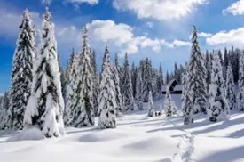
 Snow-capped mountains and a frozen lake in Wyoming, demonstrating winter conditions and snow accumulation in the Climate In Wyoming Usa
However, rapid runoff from heavy rain during thunderstorms can cause flash flooding on headwater streams. When these intense storms coincide with the peak snowmelt period, flooding is intensified, sometimes causing considerable damage in communities situated near rivers. This dynamic interplay between snow, rain, and topography is a significant aspect of the Climate In Wyoming Usa.
Due to its generally high elevation, Wyoming experiences a relatively cool climate overall. Temperatures rarely exceed 100° F above 6,000 feet. The warmest areas include the lower Big Horn Basin, lower elevations in the central and northeast, and along the eastern border. The state’s highest recorded temperature was 114° F on July 12, 1900, in Basin. In July, the average maximum temperature in Basin is around 92° F.
For most of the state, mean maximum temperatures in July typically range from 85 to 95° F. As elevation increases, these averages drop sharply. Some mountain locations at about 9,000 feet might see average maximums in July closer to a cool 70° F. Even on hot days, summer nights are almost always cool, offering a pleasant contrast. Mean minimum temperatures in July for most places away from the mountains range from 50 to 60° F. Mountains and high valleys are significantly cooler, with average lows in the mid-summer sometimes dipping into the 30s and 40s, occasionally even below freezing.
Winter in Wyoming is characterized by frequent and rapid shifts between mild and cold periods. Typically, there are fewer than 10 major cold waves each winter, often fewer than half that for most of the state. These cold air masses usually move southward on the east side of the Divide, sometimes impacting only the northeast as they slide eastward over the plains. Fortunately, many cold waves are not accompanied by heavy snow, mitigating severe conditions.
January, generally the coldest month, sees mean minimum temperatures mostly ranging from 5 to 10° F. In western valleys, values can drop to around 5° F below zero. The state’s record low is a frigid -66° F, recorded on February 9, 1933, at Yellowstone Park. During warmer winter spells, nighttime temperatures can surprisingly stay above freezing. Chinooks, the warm, dry downslope winds, are common and offer temporary relief along the eastern slopes.
Numerous valleys in Wyoming are prone to cold air drainage at night, providing ideal pockets for cold air to settle. Protected by surrounding mountains that prevent wind from mixing the air, the colder, denser air accumulates, often sending temperatures well below zero. It’s common for valley temperatures to be considerably lower than on nearby mountain sides. Big Piney in the Green River Valley is a prime example.
Mean January temperatures in the Big Horn Basin vividly show the temperature variations between the lower valley areas and higher elevations. For instance, Worland and Basin in the lower basin, near the 4,000-foot level, have a mean January minimum of zero, while Cody, closer to 5,000 feet on the west side, averages a milder 11° F. Despite occasional mild periods in January when maximums might reach the 50s, winters are typically long and cold across the state.
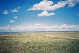
 Vast open plains in Wyoming under a clear sky, characteristic of the state’s high plains environment and climate
Wyoming is known for early freezes in the fall and late freezes in the spring, resulting in long winters and relatively short growing seasons. However, the fall, winter, and spring seasons are marked by rapid and frequent transitions between cold and mild periods. The average freeze-free period for the principal agricultural areas is approximately 125 days. For hardier plants that can tolerate temperatures around 28° F, the growing season in agricultural areas east of the Divide extends to about 145 days.
In the mountains and high valleys, freezing temperatures can occur any time during the summer months. For tender plants, there is practically no reliable growing season in areas like the upper Green River Valley, the Star Valley, and Jackson Hole. At Farson, near Sandy Creek, a tributary of the Green River, the average period between the last 32° F temperature in early summer and the first freeze in late summer is a mere 42 days. Places like the Star Valley and Jackson Hole have even shorter growing windows.
For most of Wyoming, sunshine is abundant, ranging from about 60 percent of the possible amount during winter to around 75 percent during summer. Mountain areas receive less sunshine, with the estimated amount over the northwestern mountains around 45 percent in winter. During the summer, when sunshine is both longest in duration and highest in intensity, mornings are typically clear. Cumulus clouds often develop in the afternoons, occasionally blocking the sun for a few hours.
Because of the high altitude, there is less atmosphere for the sun’s rays to penetrate, and there is minimal fog, haze, and smoke. This combination results in unusually high sunshine intensity. This bright, sunny nature contributes to the scenic beauty but also impacts factors like evaporation rates.
Precipitation across Wyoming varies significantly by location, much like in other Western states. The wettest period for most of the state occurs in the spring and early summer. Generally, precipitation is higher over mountain ranges and at higher elevations, though elevation isn’t the only determining factor. For example, in most of the southwest portion, where elevations are high (6,500 to 8,500 feet), annual precipitation is surprisingly low, ranging from 7 to 10 inches.
Conversely, lower elevations in the northeast and along the eastern border (4,000 to 5,500 feet) receive more, with annual averages between 12 and 16 inches. This relatively dry southwest area is a high plateau nearly surrounded by mountains, creating a pronounced rain shadow effect.
The Big Horn Basin is a striking example of how mountain ranges block moisture from both the east and west. The lower part of the Basin is the driest region in the state, receiving only 5 to 8 inches of annual precipitation. Seaver, at 4,105 feet, records the least amount, averaging about 5.50 inches annually. In the southern Basin, Worland (4,061 feet) averages 7 to 8 inches, compared to Termopolis (4,313 feet) with 11 to 12 inches.
Another clear example is in the southeast, where Laramie (7,236 feet) averages 10 inches annually, while Centennial (8,074 feet), just 30 miles west, receives about 16 inches. Very few locations in Wyoming record as much as 40 inches of precipitation per year, based on historical gauge data.
Summer showers are frequent but often yield only small amounts of rain. Occasionally, heavy rain associated with thunderstorms can occur over limited areas. Several local storms each year drop 1 to 2 inches of rain in a 24-hour period. Rarely, 24-hour totals can reach 3 to 5 inches. The highest 24-hour total recorded in Wyoming is 5.50 inches at Dull Center, near Newcastle, on May 31, 1927.
Wyoming has a low average relative humidity, contributing to delightful summer weather. During the warmest parts of summer days, humidity often drops to 25 to 30 percent, and sometimes as low as 5 to 10 percent. Late at night, when temperatures are lowest, humidity generally rises to 65 or 75 percent. This creates a large average daily variation of about 40 to 45 percent in summer, though the variation is much less in winter.
Low relative humidity, high sunshine percentage, and strong average winds all contribute to a high rate of evaporation. Consistent evaporation records are hard to obtain for more than the May-September period due to frequent freezing temperatures before May 1 and after September 30. For this 5-month period, average evaporation from evaporation pans at selected sites is approximately 41 inches, ranging from 30 to about 50 inches.
Hailstorms are the most destructive type of local storm in Wyoming, causing thousands of dollars in damage to crops and property annually. While hailstorms occasionally affect cities, most pass over open rangeland with minimal overall impact. However, in localized farming areas, hail can sometimes lead to complete crop loss for individual farmers.
Tornadoes occur but are far less frequent and destructive than those in the Midwest. The limited damage is partly due to Wyoming’s vast, sparsely populated open range country. Records indicate that Wyoming tornadoes tend to be smaller and have shorter durations. Many touch down for only a few minutes before dissipating. The tornado season runs from April through September, with June typically seeing the most activity, followed by May. Most tornadoes occur in the eastern part of the state.
Wyoming is notably windy. During winter, periods of sustained winds reaching 30 to 40 miles per hour are frequent, with gusts often hitting 50 or 60 mph. Prevailing wind directions vary locally, generally from west-south-west through west to northwest. In many areas, these strong, constant winds are so influential that trees exhibit a distinct lean towards the east or southeast.
Snow falls frequently from November through May. At lower elevations, snowfall is typically light to moderate. Stations at lower altitudes average about five snowfalls exceeding 5 inches per year. Falls of 10 to 15 inches or more from a single storm are infrequent outside of mountain areas. Wind often accompanies or follows snowstorms, piling snow into drifts several feet deep, making accurate snowfall measurement difficult.
An unusually heavy snowfall occurred in Sheridan on April 3rd and 4th, 1955, totaling 39.0 inches with 4.30 inches of water equivalent, accompanied by blizzard conditions for over 43 hours. High winds and low temperatures combined with snow create blizzard or near-blizzard conditions. While these can last a day or two, severe blizzards rarely persist for over three days.
Total annual snowfall varies considerably. Lower elevations in the east typically receive 60 to 70 inches. The drier southwest portion sees 45 to 55 inches. The lower Big Horn Basin is notably light on snow, averaging 15 to 20 inches, while the sides of the basin (5,000-6,000 feet) get 30 to 40 inches. Mountains receive significantly more; higher ranges can get well over 200 inches annually. Beckler River Ranger Station in southwest Yellowstone Park averages 262 inches over a 20-year period, highlighting the extreme mountain snowfall within the Climate In Wyoming Usa.
The weather pattern most favorable for precipitation in Wyoming involves a low-pressure center slightly south of the state. This setup typically brings relatively cool surface air overrun by warmer, moist air. Wind flow studies indicate Wyoming is most often covered by air masses from the Pacific. A smaller percentage of the time, the state is influenced by cold air masses descending from Canada. Understanding these air patterns is key to predicting the dynamic weather shifts Wyoming experiences.
Frequently Asked Questions About the Climate In Wyoming Usa
- What is the best time of year to visit Wyoming based on climate?
The best time depends on your planned activities. Summer (June-August) offers warm days and cool nights ideal for hiking and exploring parks like Yellowstone and Grand Teton, but be prepared for afternoon thunderstorms. Fall (September-October) brings crisp air, beautiful foliage, and fewer crowds. Winter (November-March) is perfect for snow sports but requires readiness for cold, wind, and blizzards. Spring (April-May) can be unpredictable with transitional weather. - How does the high elevation affect the weather in Wyoming?
High elevation means generally cooler temperatures year-round compared to lower regions. It also results in more intense sunshine due to less atmospheric filtering, greater day-to-night temperature swings, and significantly more snowfall in mountain areas. Visitors should be mindful of altitude sickness and pack layers. - Is Wyoming a windy state?
Yes, Wyoming is known for being windy, especially in open areas and along the eastern slopes where Chinook winds occur. Strong winds are common throughout the year but can be particularly noticeable during winter months. - How much snow does Wyoming get?
Snowfall varies dramatically. Lower elevations might get 60-70 inches annually, while mountain ranges can receive well over 200 inches. Snow can fall from early fall through late spring, and high mountain areas can see snow any month of the year. - Are severe storms like tornadoes or hailstorms common?
Hailstorms are more common and can cause significant local damage, especially to crops. Tornadoes occur, primarily in the eastern part of the state during late spring and summer, but they are less frequent and typically smaller and less destructive than those in the Midwest due to the state’s topography and sparse population.
