Washington state is a wonderland for outdoor enthusiasts, boasting a stunning tapestry of landscapes from rugged coastline to towering volcanic peaks and dense evergreen forests. While a day hike offers a taste of this beauty, spending a night out on the trail through backpacking truly immerses you in the wilderness, offering unparalleled tranquility and unforgettable views of starry skies, sunsets, and sunrises. Backpacking Trails Washington provide access to some of the most rewarding experiences the state has to offer.
If you’re looking to explore the diverse topography and serene natural beauty of the Pacific Northwest, Washington state is an incredible place to lace up your boots. We’re fortunate to have thousands of miles of trails leading to unbelievable locations. The prime summer season (mid-June through mid-September) is perfect for exploring high alpine routes, but many lower-elevation trails are accessible earlier or later in the year, sometimes even year-round. Based on our own adventures, we’ve compiled a list of top picks for overnight Backpacking Trails Washington, ordered roughly by increasing difficulty.
Beginner-Friendly Backpacking Trails in Washington
For those new to strapping everything they need onto their backs, starting with shorter distances and minimal elevation gain is key. These trails offer a fantastic introduction to the world of overnight backpacking, providing beautiful scenery without overwhelming physical demands. Some are also great for spring and early summer when higher trails are still snowbound.
One excellent way to ease into backpacking is coastal camping, where trails often have less elevation change compared to mountain routes. These trips allow you to focus on managing your pack and overnight setup while enjoying the unique environment of Washington’s shoreline.
Sheep Lake
Stats: 3.6 miles roundtrip, 400′ elevation gain
Area: Mount Rainier area
Distance from Seattle: 1 hour, 48 min
Pass/Permit: Northwest Forest Pass
Dogs Allowed? Yes, on leash
Sheep Lake offers a gentle entry into backpacking near Mount Rainier. The trail leads steadily uphill to a picturesque lake framed by surrounding peaks. It’s an ideal spot to set up camp and enjoy a relaxed evening. For a bit of extra exploration without the full pack the next day, you can day-hike from the lake up and over Sourdough Gap to Crystal Lake, which offers stunning additional views.
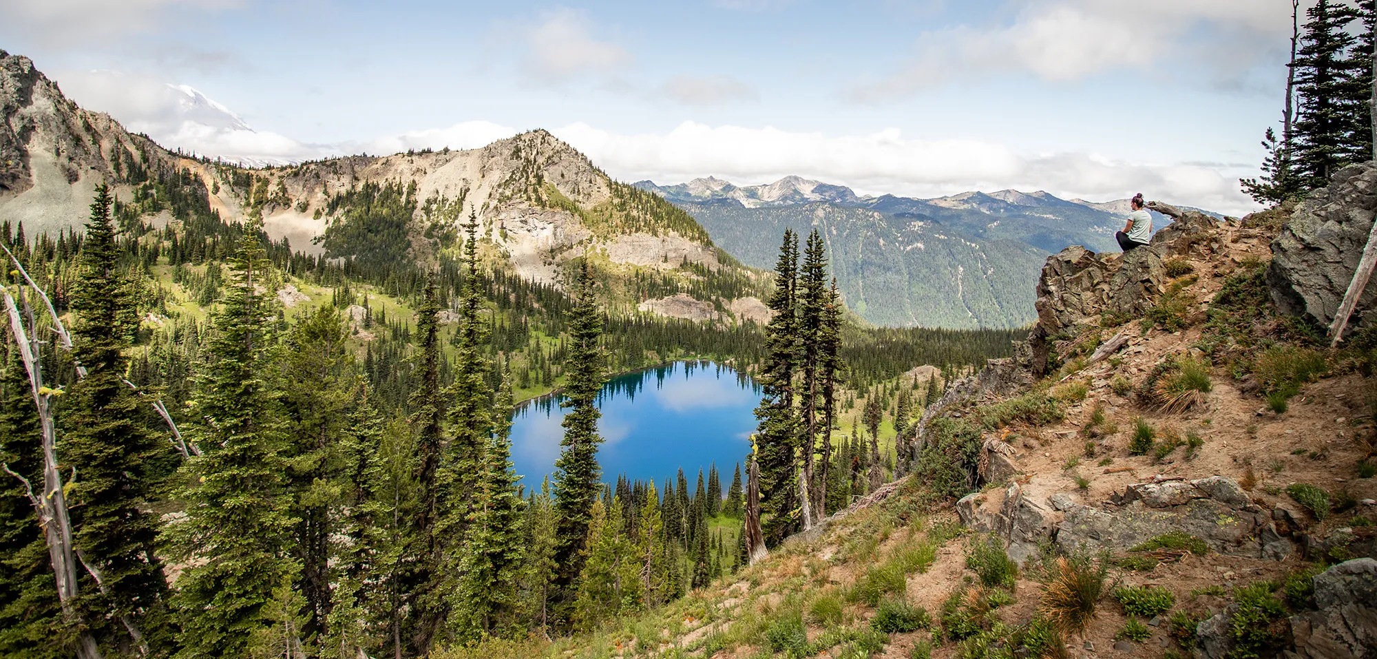
Sheep Lake
Views overlooking Crystal Lake after hiking from Sheep Lake. This adds some elevation and mileage but is highly recommended for experienced day hikers from your base camp.
Skyline Divide*
Stats: 9 miles roundtrip, 2,500′ elevation gain**
Area: North Cascades, Mount Baker area
Distance from Seattle: 2 hours, 30 min
Pass/Permit: Northwest Forest Pass
Dogs Allowed? Yes, on leash
Skyline Divide, located in the Mount Baker area of the North Cascades, is renowned for its incredible wildflower displays and expansive views. Although the total stats can look intimidating, the trail offers camping options relatively early on. By setting up camp around the 2-mile mark, you can offload your heavy gear and continue exploring the ridge with a lighter day pack, making it quite manageable for beginners.
Discover the Best Overnight Summer Camps in Texas
Your Ultimate Guide to Oktoberfest Los Angeles 2024
Discover the Best Things to See in Sarasota
*Note: As of July 2023, road conditions impacted access. Always check current conditions before planning your trip. **Stats are for the full trail; camping earlier reduces packed mileage. Remember to camp only in designated areas to protect the delicate alpine meadows and wildflowers.
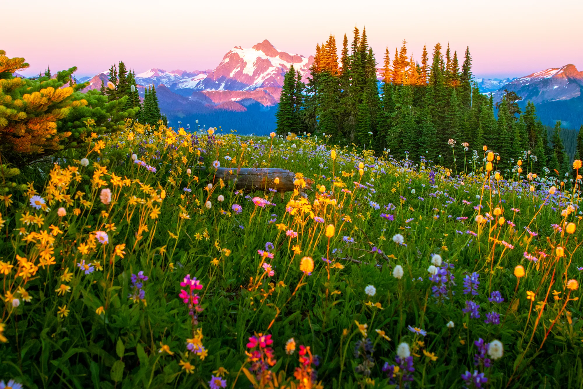 Skyline Divide
Admiring vibrant wildflowers with the majestic Mt. Shuksan standing tall in the background along the Skyline Divide trail.
Summit Lake
Stats: 6.1 miles roundtrip, 1,300′ elevation gain
Area: Mount Rainier
Distance from Seattle: 1 hour, 46 min
Pass/Permit: Northwest Forest Pass
Dogs Allowed? Yes, on leash
Summit Lake provides classic Mount Rainier views reflected in deep blue water. The trail offers gradual gain to the lake. For even more spectacular scenery, push slightly higher to Summit Lake Ridge – if you can secure a coveted campsite here, you’ll wake up to arguably the best panoramas of Mount Rainier. Time your visit for mid to late July to catch the beautiful avalanche lilies near the ridge.
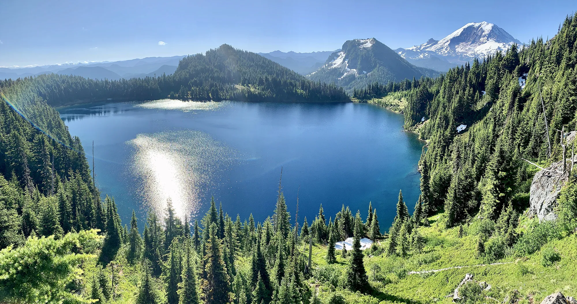 Summit Lake Ridge campsite view
The stunning view from a campsite located on the ridge above Summit Lake, showcasing Mount Rainier.
Moderate Backpacking Trails in Washington
These trails offer a step up in challenge, often involving more significant elevation gain or longer distances, while still being accessible to backpackers with some experience and fitness. They reward your effort with stunning alpine scenery, remote lakes, and unique historical remnants.
Tubal Cain Mine to Buckhorn Lake
Stats: 12 miles roundtrip, 2,000′ elevation gain
Area: Olympic Peninsula
Distance from Seattle: 3-3.5 hours
Pass/Permit: Wilderness permit – self-issue at trailhead (no fee)
Dogs Allowed? Yes, on leash
Located on the Olympic Peninsula, this trail offers a mix of forest walking and alpine beauty. The lower sections can be vibrant with rhododendrons in early summer. The destination, Buckhorn Lake, is a beautiful turquoise gem. A unique aspect of this trail is the option to visit the remnants of an old plane crash nearby. For a longer trip, you can connect to other trails like the one leading to Marmot Pass.
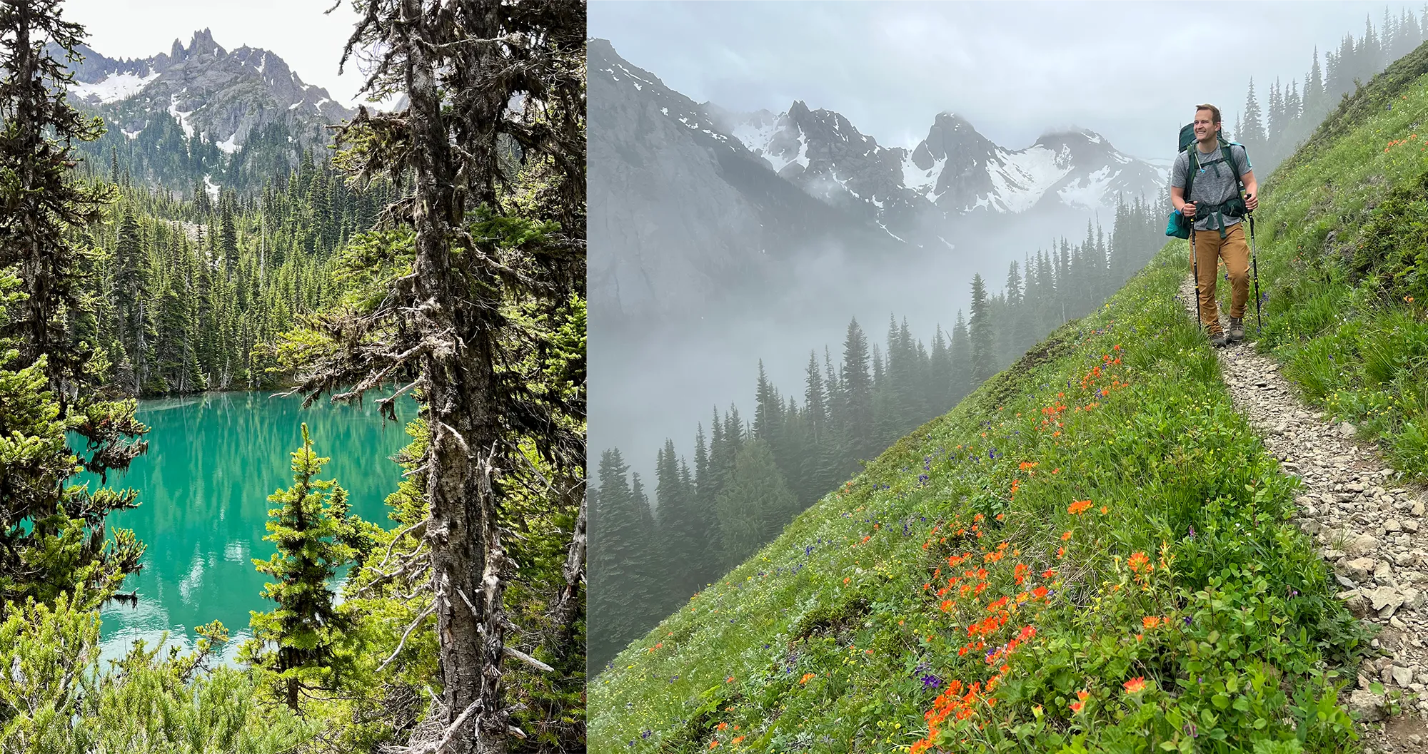 Buckhorn Lake and trail
Buckhorn Lake gleaming turquoise on the left, and the trail winding through moody Pacific Northwest weather on the right.
Park Butte
Stats: 7.5 miles roundtrip, 2,200′ elevation gain
Area: North Cascades, Mount Baker area
Distance from Seattle: 2 hours, 13 min
Pass/Permit: Northwest Forest Pass
Dogs Allowed? Yes, on leash
The hike to Park Butte Fire Lookout is a Washington classic, offering breathtaking views of Mount Baker, the Twin Sisters, and the surrounding North Cascades. The goal is the historic fire lookout perched atop the ridge, offering panoramic vistas. If you arrive early and it’s available, you might even be able to camp inside the lookout on a first-come, first-served basis, providing an unforgettable overnight experience high above the landscape.
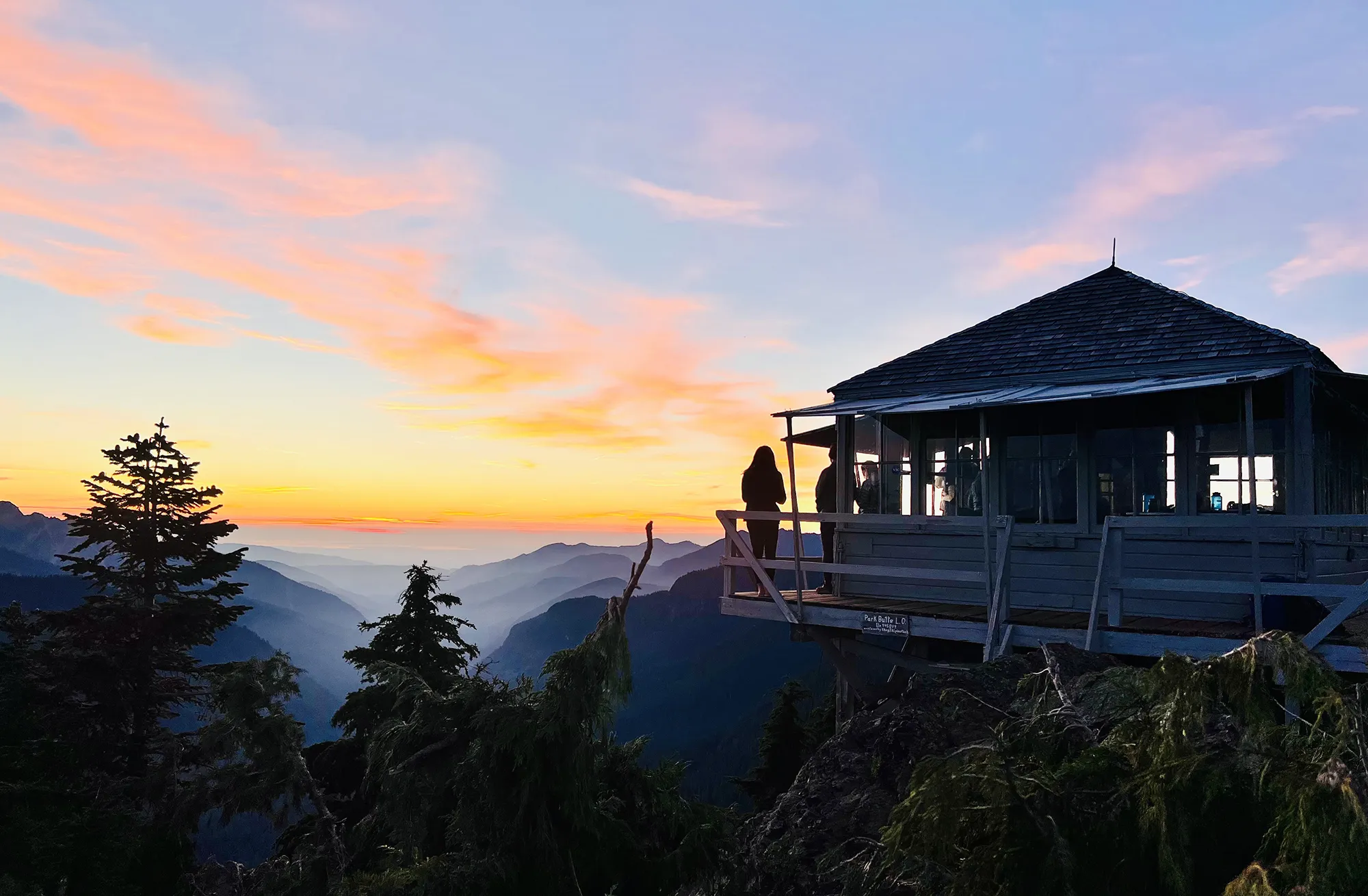 Park Butte Fire Lookout
The iconic Park Butte Fire Lookout glowing during sunset, a sought-after spot for backpackers.
Lake Ingalls
Stats: 9 miles roundtrip, 2,500′ elevation gain
Area: Snoqualmie Region, Salmon La Sac/Teanaway
Distance from Seattle: 2 hours, 19 min
Pass/Permit: Northwest Forest Pass
Dogs Allowed? No
Lake Ingalls is famous for its stunning deep blue water and the dramatic backdrop of Mount Stuart. Camping is not allowed directly at the lake shore to preserve the fragile environment. However, Headlight Basin, located about 0.8 miles before the lake, offers numerous campsites with excellent views of Mount Stuart and facilities like a nearby toilet. Be prepared for potentially strong winds in Headlight Basin and choose a sheltered spot if possible. You might even encounter some friendly mountain goats in the area!
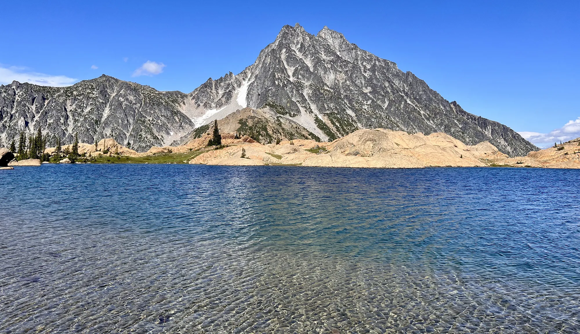 Lake Ingalls
Looking over the deep blue waters of Lake Ingalls towards the imposing Mount Stuart, a highlight of this Snoqualmie region trail.
Snowgrass Flats and Goat Lake Loop
Stats: 12.3 miles roundtrip, 2,706′ elevation gain
Area: South Cascades, Goat Rocks area
Distance from Seattle: 3 hours
Pass/Permit: Wilderness permit – self-issue at trailhead (no fee)
Dogs Allowed? Yes, on leash
This loop trail in the Goat Rocks Wilderness provides constantly changing scenery, making it a truly engaging backpack. It features everything from vast meadows (Snowgrass Flats) to alpine lakes (Goat Lake) and incredible mountain views, including Mount Adams. We were lucky enough to witness a spectacular cloud inversion here at sunrise. While Goat Lake can be windy, the views are worth it. For the ambitious, a side trip up Old Snowy Mountain offers even higher perspectives.
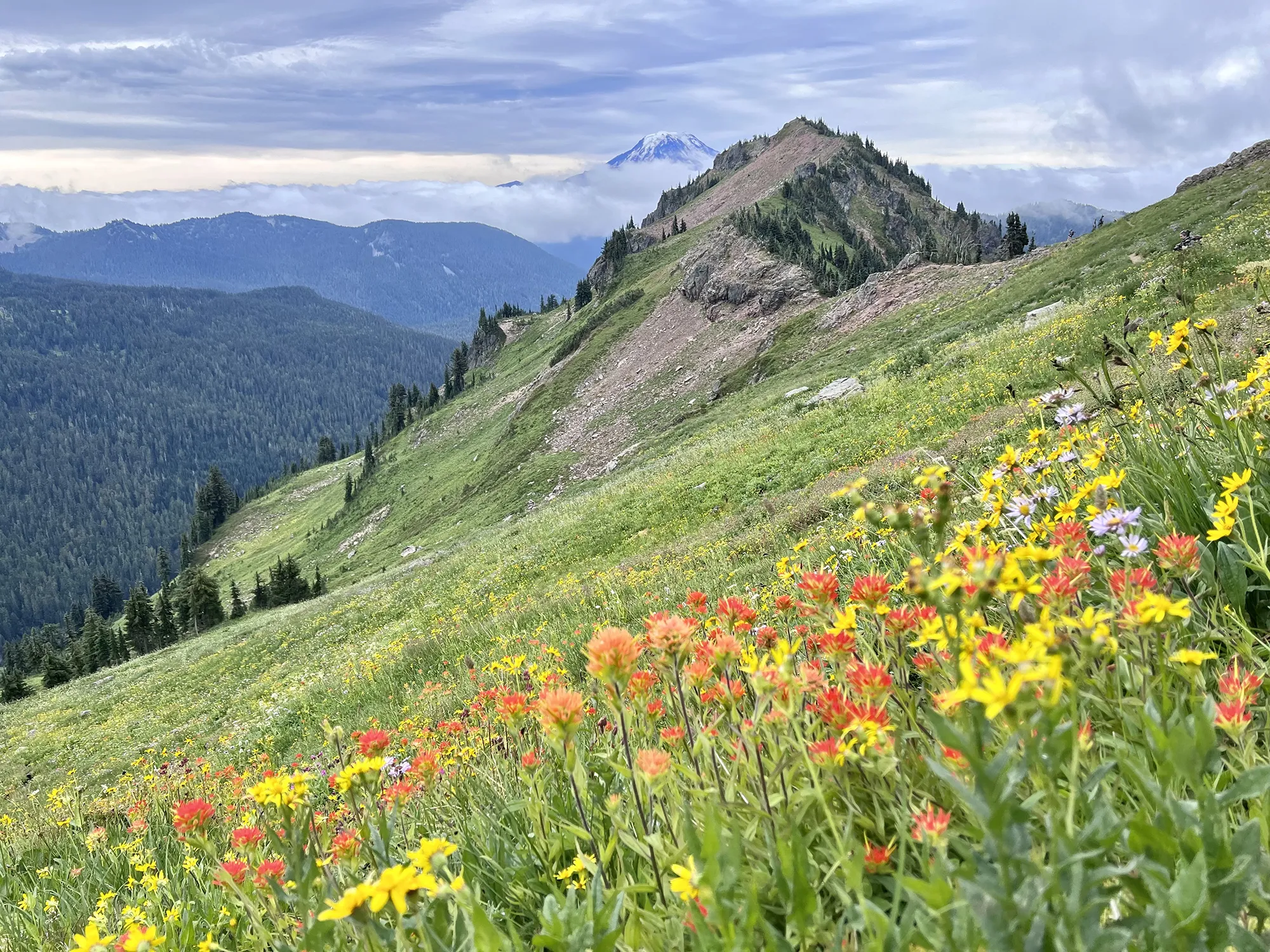 Snow Grass Flats wildflowers
Plentiful wildflowers line the trail as hikers approach Goat Lake, adding vibrant color to the landscape.
Paddy-Go-Easy Pass
Stats: 6 miles roundtrip, 2,560′ elevation gain
Area: Snoqualmie Region, Salmon La Sac/Teanaway
Distance from Seattle: 2 hours, 25 min
Pass/Permit: Wilderness permit – self-issue at trailhead (no fee)
Dogs Allowed? Yes, on leash
While the mileage isn’t exceptionally high, the elevation gain concentrated over a shorter distance makes Paddy-Go-Easy Pass a challenging climb. However, the reward is solitude and stunning views of Sprite Lake and Mount Daniel. This trail is less known than some others, offering a peaceful wilderness experience. There’s even a small, old mine shaft remnant near the ridge for those curious about the area’s history (exercise caution around it!).
![]() Sprite Lake from ridge
Sprite Lake from ridge
Overlooking the beautiful Sprite Lake from a ridge near the old mine shaft remnants at Paddy-Go-Easy Pass.
Challenging Backpacking Trails in Washington
These trails demand significant fitness, stamina, and often route-finding skills. They typically involve substantial elevation gain, longer distances, and potentially rugged terrain. The payoff is access to remote, high-alpine environments and truly spectacular, hard-earned views.
Navaho Peak
Stats: 13.7 miles roundtrip, 4,223′ elevation gain*
Area: Snoqualmie Region, Salmon La Sac/Teanaway
Distance from Seattle: 1 hour, 58 min
Pass/Permit: Northwest Forest Pass
Dogs Allowed? Yes, on leash
Navaho Peak is a strenuous but incredibly rewarding hike. The overall stats can seem daunting, but you can manage the challenge by breaking it up. Consider camping in the meadow area below Navaho Pass (always on dirt, not grass) and then tackling the final push to the summit with a lighter day pack on the second day. The climb to the peak is steep, but reaching the top provides truly breathtaking 360-degree views of the surrounding mountain ranges.
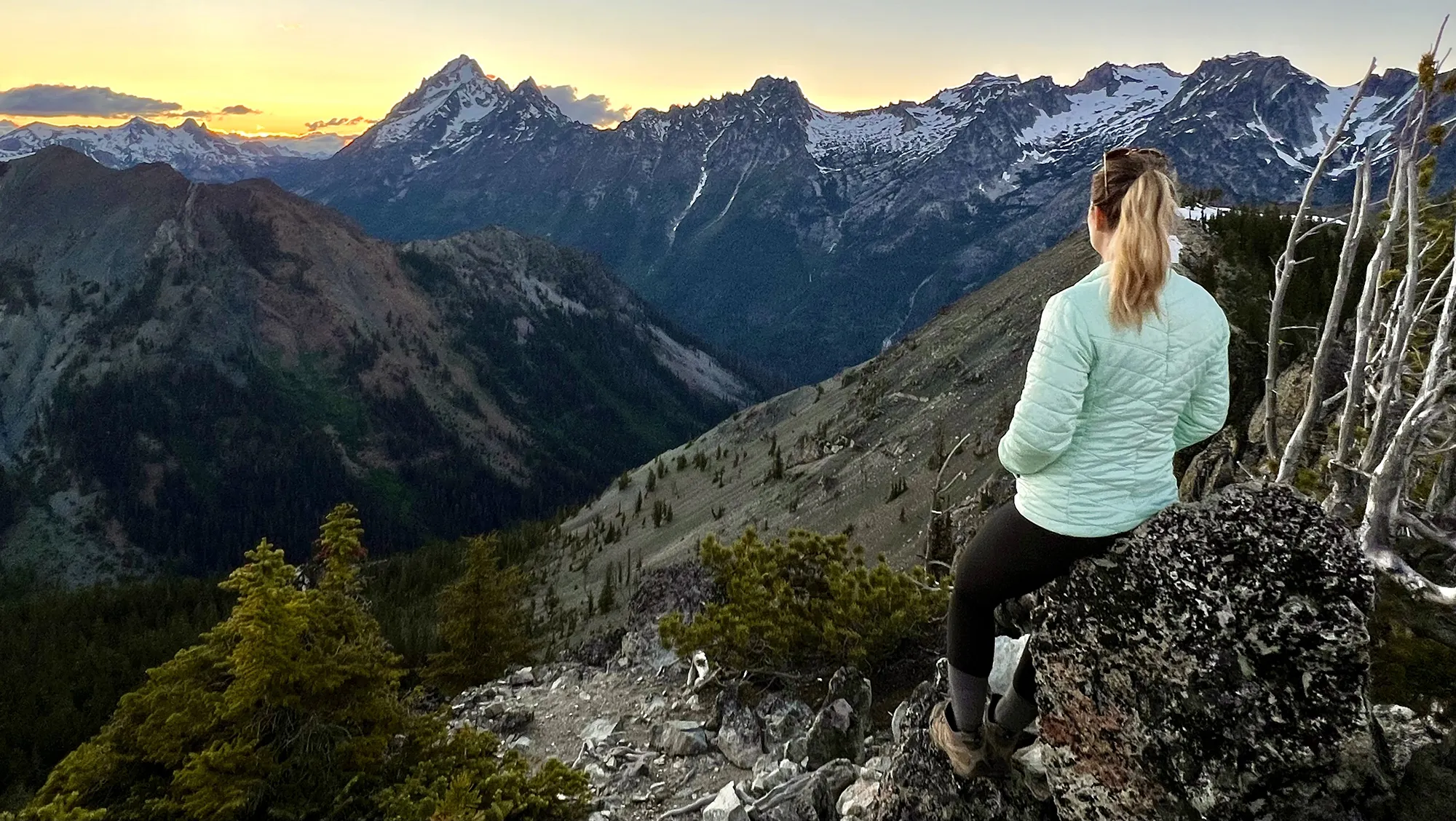 Navaho Peak meadow sunset
Sunset views illuminating the majestic Mt. Stuart range from the meadow below Navaho Pass, a great base camp for Navaho Peak.
Rachel & Rampart Lakes
Stats: 9 miles roundtrip, 2,539′ elevation gain*
Area: Snoqualmie Pass
Distance from Seattle: 1 hour, 23 min
Pass/Permit: Northwest Forest Pass
Dogs Allowed? Yes, on leash
This trail near Snoqualmie Pass is deceptively challenging; the first 2.5 miles are relatively flat, meaning most of the significant elevation gain (2,539 ft) is packed into a shorter, steeper section over about two miles. The trail can also be rocky, wet, and root-filled, requiring careful footing. While Rachel Lake is beautiful, pushing on to Rampart Lakes is highly recommended for better camping options and even more stunning scenery amongst a collection of interconnected lakes. The climb between the two is steep but relatively short.
*Note: Much of the gain is concentrated in a short section after the initial flat miles.
 Rachel Lake view from above
Looking down onto Rachel Lake while ascending the steep trail towards the higher Rampart Lakes area.
Marmot Pass via Upper Big Quilcene Trail
Stats: 11.5 miles roundtrip, 3,489′ elevation gain
Area: Olympic Peninsula
Distance from Seattle: 2 hour, 30 min
Pass/Permit: Northwest Forest Pass
Dogs Allowed? Yes, on leash
This route to Marmot Pass on the Olympic Peninsula offers significant elevation gain through beautiful forest before breaking out into stunning alpine meadows. The climb can feel relentless, but the views from the pass are absolutely incredible, especially at sunrise. Many hikers choose to set up camp at Camp Mystery, located before the final push to the pass, to tackle the summit views in the morning. Always use established campsites to protect the fragile meadows and wildflowers.
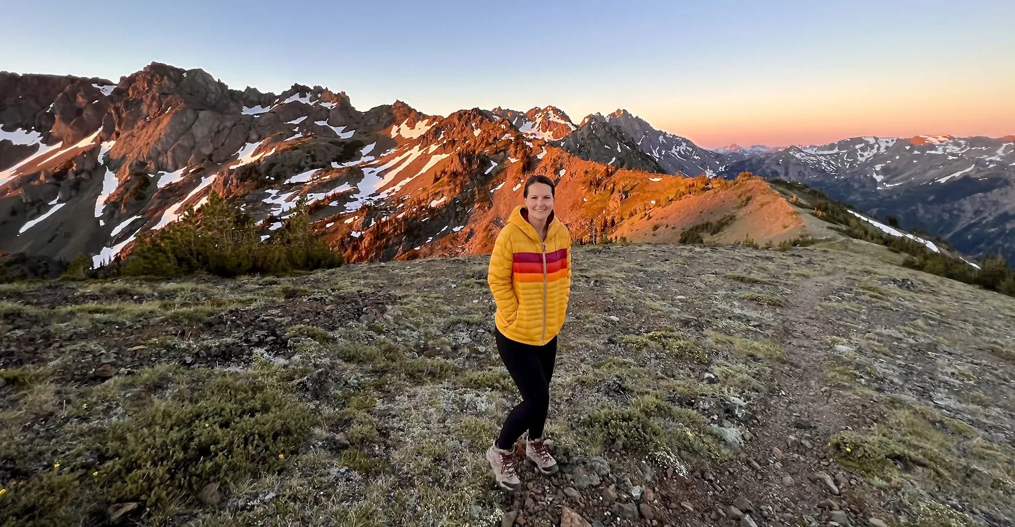 Marmot Pass sunrise
Capturing the stunning sunrise from the ridge near Marmot Pass on the Olympic Peninsula, a rewarding view after a challenging ascent.
Surprise Lake to Thunder Mountain Lakes
Stats: 14.5 miles roundtrip, 4,287′ elevation gain
Area: Stevens Pass
Distance from Seattle: 1 hour, 30 min
Pass/Permit: Northwest Forest Pass
Dogs Allowed? Yes, on leash
This extensive backpacking trip connects multiple gorgeous alpine lakes near Stevens Pass. Starting from the Surprise and Glacier Lakes trailhead, you can plan an itinerary that includes camping at both Surprise Lake and the higher Thunder Mountain Lakes. The connector trail between the two involves a seemingly endless series of switchbacks, but the effort is rewarded upon reaching Trap Pass with views of Trap Lake, followed by the beautiful Thunder Mountain Lakes themselves. Camping options at the upper lakes can be limited and often on rocky ground, but the views upon waking are truly spectacular.
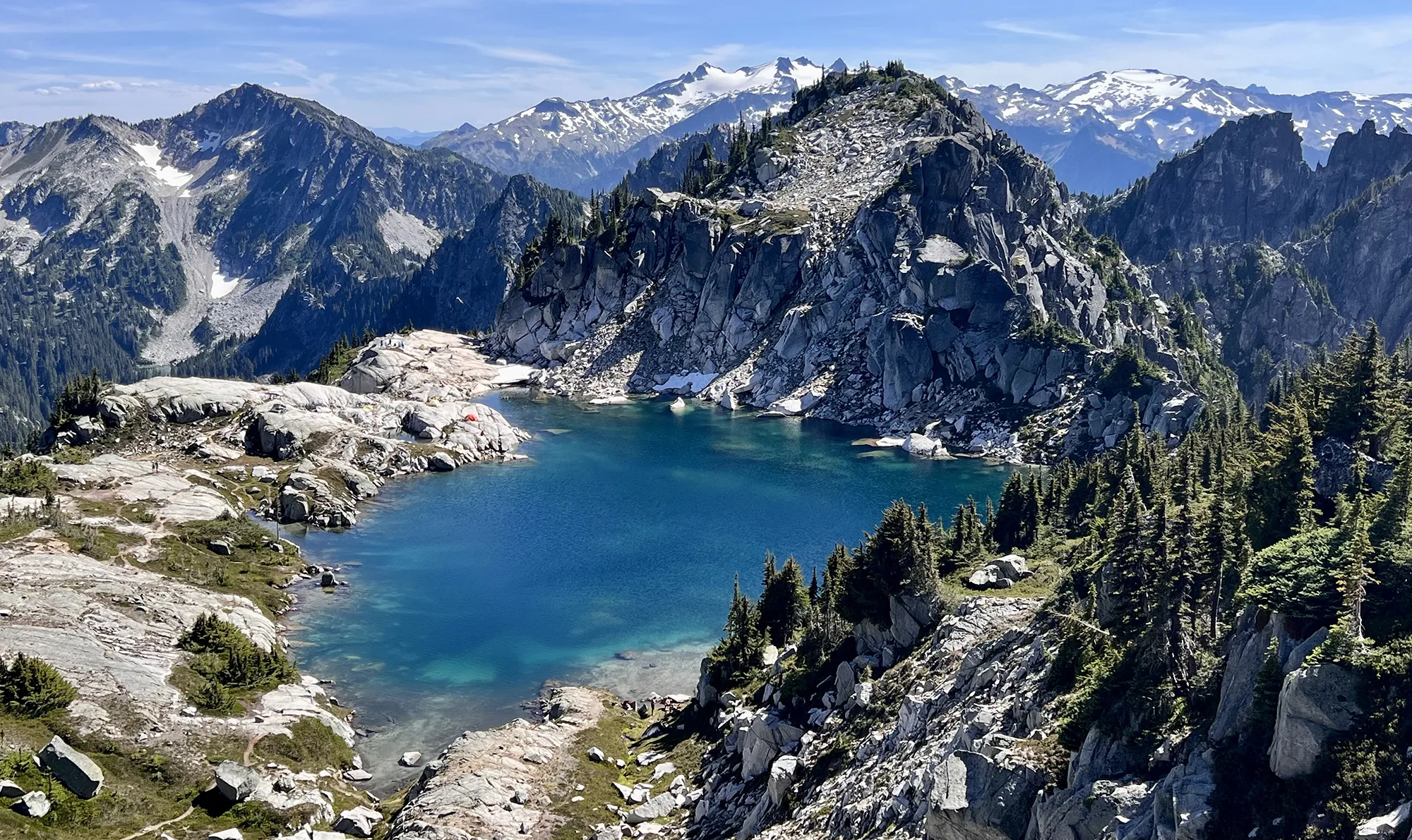 Thunder Mountain Lake from ridge
Looking down on Thunder Mountain Lake from a nearby ridge, showcasing the serene alpine setting.
Lewis and Wing Lakes
Stats: 12 miles roundtrip, 2,652′ elevation gain
Area: North Cascades
Distance from Seattle: 3 hours
Pass/Permit: Northwest Forest Pass
Dogs Allowed? Yes, on leash
Lewis and Wing Lakes in the North Cascades were a long-anticipated destination that lived up to the hype, especially when visited in the fall for the stunning golden larches. The trail shares the initial section with the popular Heather-Maple Pass Loop before branching off. Be prepared for a significant boulder field shortly after the turnoff. The lakes themselves, particularly the glowing turquoise Lewis Lake, are breathtaking. The final push between Lewis and Wing Lakes is steep and rugged but offers incredible views back down. Experienced hikers can even scramble to Black Peak for even higher perspectives.
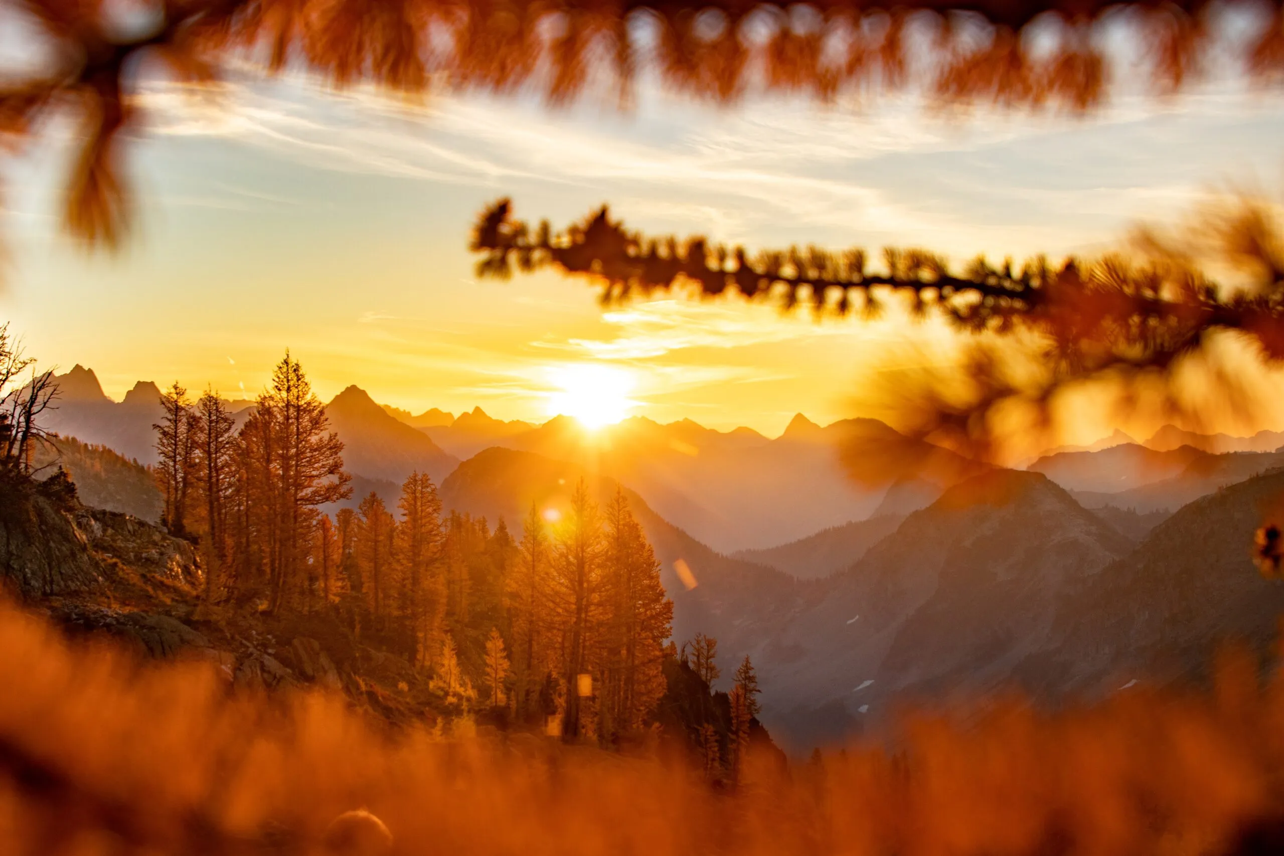 Lewis and Wing Lakes in fall
Witnessing a glorious sunrise paint the North Cascades mountains gold, overlooking the area around Lewis and Wing Lakes during fall larch season.
Tuck & Robin Lakes
Stats: 11.96 miles roundtrip, 3,354′ elevation gain
Area: Snoqualmie Region, Salmon La Sac/Teanaway
Distance from Seattle: 2 hours, 30 min
Pass/Permit: Northwest Forest Pass
Dogs Allowed? Yes, on leash
While the initial miles are flat, the final approach to Tuck and Robin Lakes involves an extremely steep climb (around 2.5 miles of concentrated gain), making this one of the most physically demanding trails on this list. Despite the challenge, Robin Lakes offers an absolutely stunning alpine basin with multiple pristine lakes and incredible views. It’s a gorgeous destination, but definitely one to tackle after building some backpacking fitness. The effort is rewarded with truly spectacular campsites overlooking the lakes.
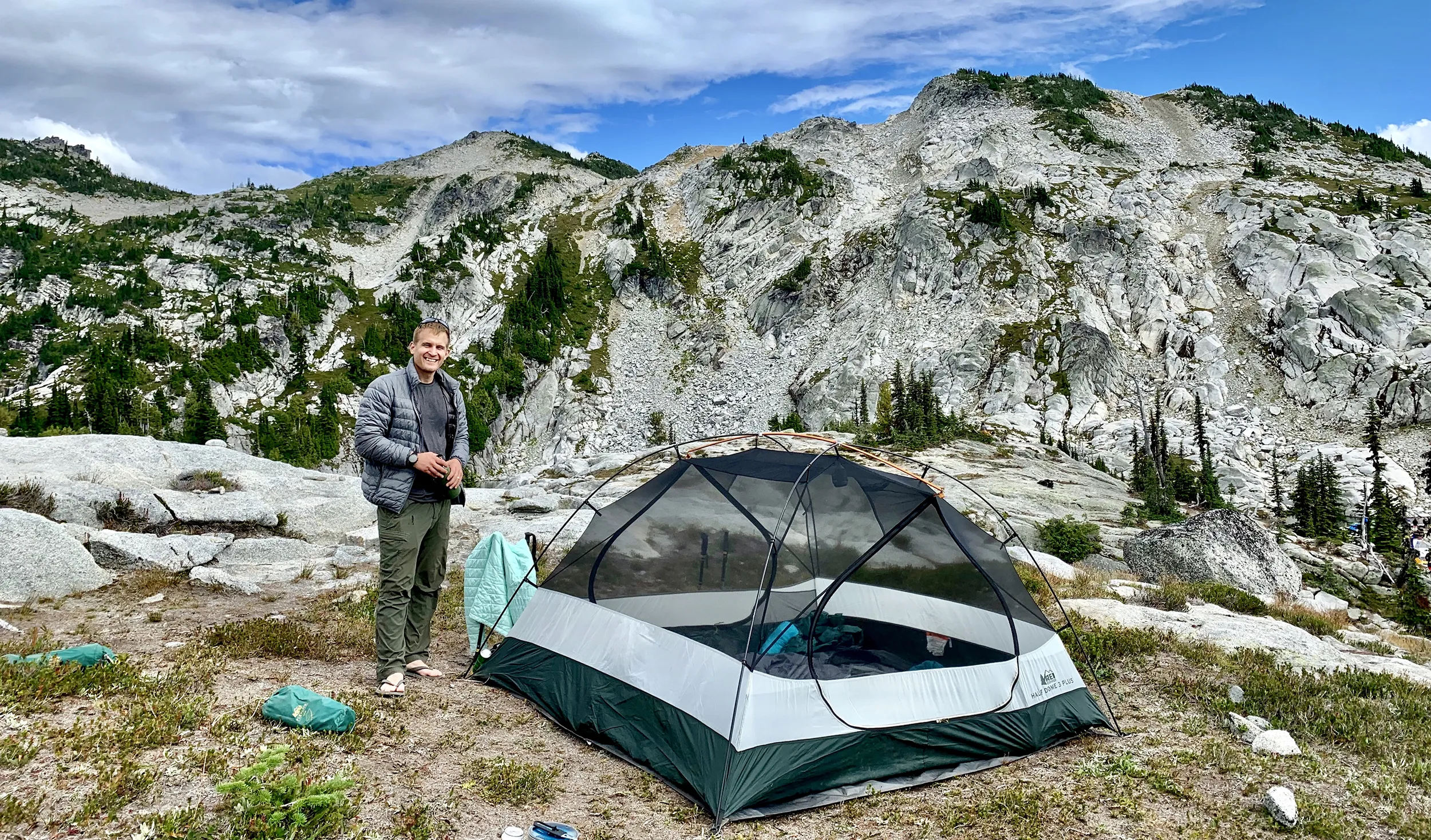 Robin Lakes from campsite
Overlooking the stunning Robin Lakes basin directly from a campsite, showcasing a not-so-bad place to wake up!
Planning Your Backpacking Trip in Washington
Choosing the right trail is just the first step. Successful backpacking in Washington requires careful planning. This includes researching the specific trail conditions (snow levels, water sources, potential closures), understanding permit requirements, practicing Leave No Trace principles to protect the wilderness, and being prepared for variable weather, which can change rapidly in the mountains. Washington state’s beauty is vast and fragile; responsible recreation ensures these incredible places remain accessible for future generations.
Frequently Asked Questions about Backpacking Trails Washington
What permits are required for backpacking in Washington state?
Permit requirements vary depending on the land management agency (National Park Service, Forest Service, DNR, etc.) and specific area. Some popular trails require advance reservation permits, while others are self-issue at the trailhead (often free). Always check the requirements for your chosen trail before heading out.
When is the best time to backpack in Washington?
The prime season for high-alpine backpacking in Washington is typically mid-June through mid-September, after snow melts and before it returns. Lower elevation trails can be accessible earlier (spring) and later (fall), offering opportunities for shoulder-season trips, sometimes even year-round in certain areas.
What should beginners pack for an overnight backpacking trip?
Essential gear for beginner backpacking includes a backpack, tent, sleeping bag, sleeping pad, proper hiking boots, navigation tools (map, compass, GPS/phone app), headlamp, first-aid kit, plenty of water and a filter/purifier, food, layers of clothing, rain gear, and sun protection. Renting gear is a great way to start.
Exploring the Backpacking Trails Washington offers is an incredible way to connect with nature and challenge yourself. Whether you’re seeking a gentle lakeside stroll or a strenuous alpine ascent, there’s a trail waiting to be discovered.
