Welcome, fellow explorers, to the breathtaking landscapes of Oregon! As a passionate traveler and content creator, I’ve spent countless hours traversing this magnificent state, from its rugged coastline to its dramatic mountain peaks and high desert plains. Our own journey began in 2020, living out of a minivan and falling deeply in love with everything Oregon offers, especially its incredible hiking trails. This state truly is a hiker’s paradise, boasting unparalleled natural beauty just waiting to be discovered.
Fast forward a few years, and we now call Portland home, allowing us to explore even more of Oregon’s diverse terrain. Whether you’re seeking towering waterfalls, challenging summit climbs, or serene lakeside strolls, an Oregon hiking trip promises unforgettable experiences. This guide, born from our personal adventures, is designed to help you plan your own journey through the state’s most stunning trails. We’ll cover essential logistics, highlight our favorite hikes, and provide tips to make your trip smooth and enjoyable. Let’s lace up our boots and dive in!
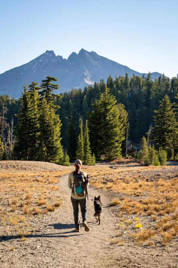 Enjoying the scenery on an Oregon hiking trip near Moraine Lake
Essential Logistics for Your Oregon Hiking Trip
Before you hit the trails, there are a few crucial things to keep in mind to ensure a smooth and responsible adventure in Oregon.
Know Your Passes
Accessing Oregon’s incredible hiking spots often requires a parking or entry pass. It can get a bit confusing, as trails fall under different jurisdictions – National Forest, State Parks, and National Parks.
A Northwest Forest Pass ($30 annual) is essential for trailheads within National Forests in both Oregon and Washington. Most popular hikes are on this land. If you plan to visit multiple National Parks across the country within a year, the America the Beautiful Pass ($80 annual) is a better investment, as it covers all federal lands, including National Forests. You can often buy these online or at outdoor retailers like REI.
For hikes in Oregon State Parks, an Oregon State Parks Pass ($30 annual or $5 daily fee) is required. An annual pass is cost-effective for Oregon residents or frequent visitors. Day use fees can usually be paid on-site. Check the specific requirements for each trailhead.
Be Prepared for Oregon Weather
Oregon’s weather is notoriously unpredictable, especially between late fall and late spring (November to June). Waterproof hiking boots or shoes are almost always a good idea. A solid waterproof rain jacket is also essential, even on days that start sunny.
Mud is a common trail condition throughout the year, particularly on the coast and after rain. Check recent trail reports online before you go. Bringing an extra pair of shoes to change into for the drive home will make your post-hike experience much more comfortable if you encounter muddy conditions.
Respect Trail Etiquette and Leave No Trace
Oregonians deeply value their natural spaces, and trails can get very crowded, particularly on weekends and during peak season (summer). Arrive early – before 9:00 am, ideally before 8:00 am – to secure parking and avoid congestion.
Many trails are dog-friendly, but dogs must be on a leash at all times. Note that dogs are generally not allowed on trails within Crater Lake National Park or some Nature Conservancy properties like Cascade Head. Always check specific trail rules.
Practice Leave No Trace principles diligently. Pack out everything you pack in, including all trash. This applies to dog waste too – be a responsible pet owner. Help preserve these beautiful places for everyone to enjoy.
Your Dream Oregon Hiking Trip: Exploring the Best Trails
Now, for the exciting part – diving into our favorite trails that define an epic Oregon hiking trip. We’ve personally hiked all the trails listed in this main section, offering you firsthand insights and tips.
We’ve organized this list based on our personal preferences, acknowledging that “best” is subjective! This is a curated selection of truly amazing hikes that we think showcase the best of Oregon’s diverse landscapes.
The McNeil Point Trail (Mount Hood National Forest)
- Length: 11 miles
- Elevation Gain: 2,700 ft.
- Trail Type: Lollipop
- Difficulty: (Very) Hard
- Pass Required? Northwest Forest Pass or America the Beautiful Pass
- Dog-Friendly? Yes, on a leash (with caveats)
- Trailhead Location: Top Spur Trailhead
Often topping our list, the McNeil Point Trail offers views of Mount Hood that are nothing short of spectacular. However, these views are hard-earned. This is a strenuous hike that will challenge even experienced hikers. We tackled this during our initial Oregon road trip when we were hiking daily and it still tested our limits!
The trail provides stunning vistas from early on, including the iconic view of Mount Hood from Bald Mountain about a mile in. The main climb leads to a junction near the top. You can choose the more direct, somewhat scrambly route (going right) or a longer, gentler meander through meadows (going left).
Planning Your travel to las vegas nevada
Plan Your Perfect Mackinac Island Vacation – Your Essential Guide
Exploring Cities In Las Vegas – Uncovering Nearby Wonders 2025
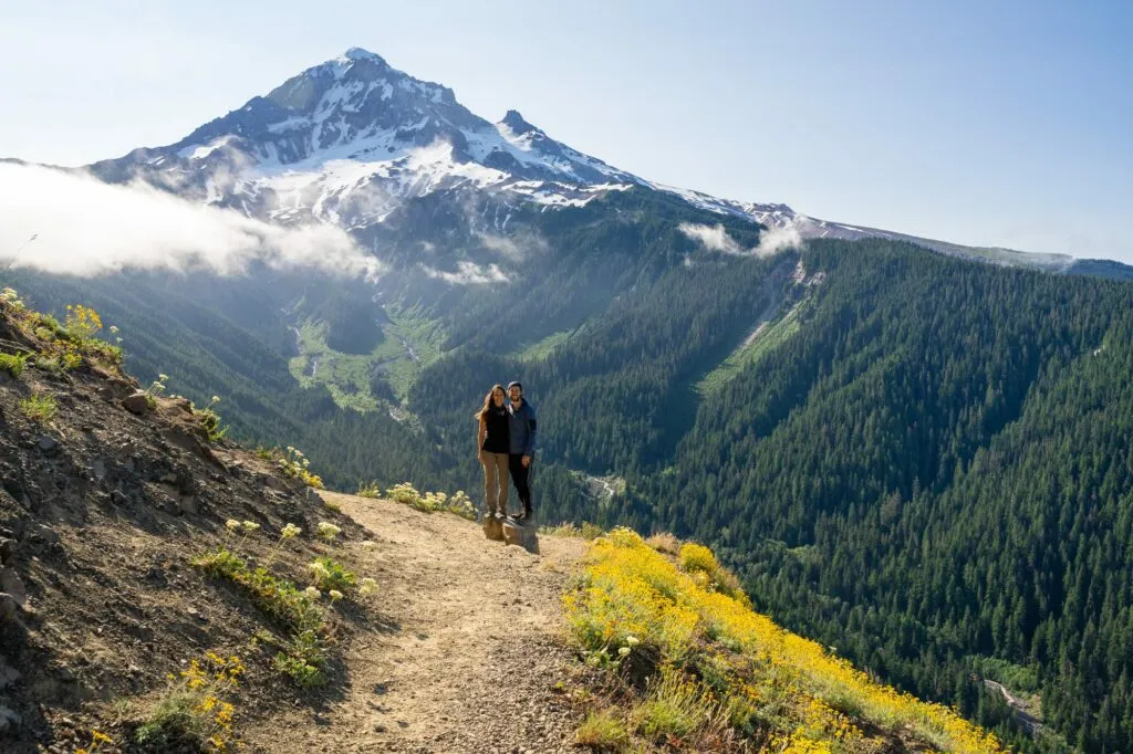 Panoramic view of Mount Hood from the McNeil Point Trail during an Oregon hiking trip
We highly recommend the out-and-back version that avoids the scramble, adding about 1.5 miles but skipping the potentially tricky climb/descent. If you do attempt the scramble section, it’s generally safer to go up it rather than down. Note that dogs are not suited for the scramble section, so stick to the out-and-back route with your furry friend.
At the summit, you’ll find a historic stone shelter built by the Civilian Conservation Corps, offering a welcome break from the wind. The views of Mount Hood, and on clear days, Mount St. Helens and Mount Adams to the north, are simply breathtaking, especially when the subalpine wildflowers are in bloom. Bring ample water and snacks for this rewarding, but difficult, Mount Hood hike.
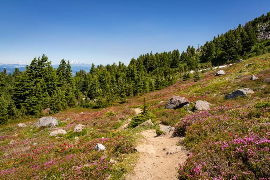 Colorful wildflowers bloom along the McNeil Point Trail, enhancing the Oregon hiking experience
The Trail of Ten Falls (Silver Falls State Park)
- Length: 7.5 miles
- Elevation Gain: 1,200 ft.
- Trail Type: Loop
- Difficulty: Easy / Moderate
- Pass Required? Oregon State Parks Pass OR $5 Day Use Fee
- Dog-Friendly? Limited (Rim Trail only)
- Trailhead Location: Silver Falls State Park South Falls Day Use Area
If your Oregon hiking trip involves chasing waterfalls, the Trail of Ten Falls at Silver Falls State Park is an absolute must-do. Located about 90 minutes south of Portland, this park is renowned for its numerous cascades.
As the name suggests, this loop trail takes you past ten distinct waterfalls. The elevation gain is gradual throughout, making the 7.5 miles feel very manageable for most hikers. Don’t be intimidated by the distance if you’re comfortable with longer walks.
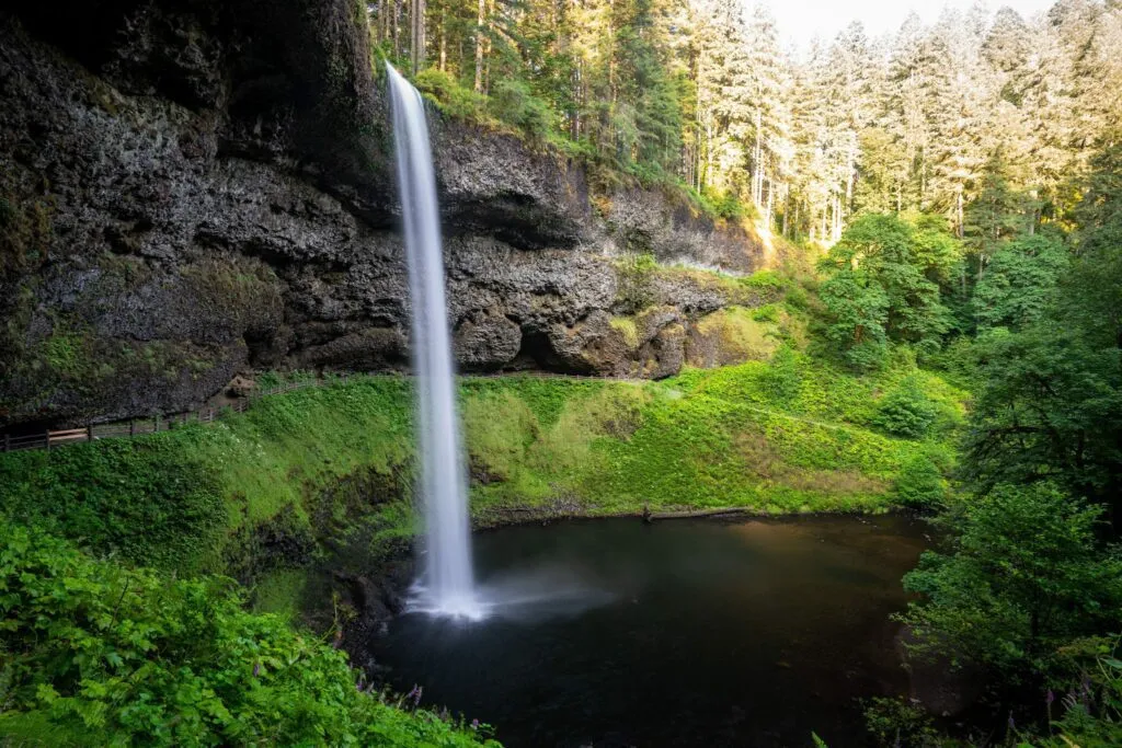 South Falls, a spectacular waterfall on the Trail of Ten Falls in Silver Falls State Park, Oregon
The most popular starting point is the South Falls Trailhead, which has a large parking area that still fills up quickly on weekends. Starting clockwise from South Falls allows you to descend past the main attractions and enjoy a more gradual uphill finish.
South Falls, at 177 feet, is the most impressive, and you can famously walk behind its powerful curtain of water for a unique perspective. Other highlights include North Falls and Double Falls. This trail provides a consistently rewarding experience with the constant sound and sight of falling water. Note for dog owners: dogs are only permitted on the Rim Trail portion, which doesn’t include the waterfalls, so this hike isn’t ideal if you want to bring your dog.
![]() Walking behind Lower South Falls on the iconic Trail of Ten Falls in Oregon
Walking behind Lower South Falls on the iconic Trail of Ten Falls in Oregon
The Iron Mountain / Cone Peak Loop (Willamette National Forest)
- Length: 6.1 miles
- Elevation Gain: 1,800 ft.
- Trail Type: Loop
- Difficulty: Moderate
- Pass Required? Northwest Forest Pass or America the Beautiful Pass
- Dog-Friendly? Yes, on leash
- Trailhead Location: Tombstone Pass / Cone Peak Trailhead
Sometimes the best discoveries on an Oregon hiking trip are unplanned. This loop was a serendipitous detour that resulted in one of the most spectacular wildflower displays we’ve ever witnessed.
This hike truly shines in the late spring and early summer when the meadows erupt in a riot of colors – reds, yellows, purples, and whites. It’s a visual feast.
 Blanket of wildflowers covers Cone Peak on the Iron Mountain trail in Oregon
The most common approach is clockwise, starting with the climb to Iron Mountain, which rewards you with a stunning 360-degree panorama of the Cascade Range. From there, the trail descends towards Cone Peak (which feels more like a hill after Iron Mountain) and then switchbacks back through the forest to the trailhead.
Doing it clockwise gets the main climb out of the way early and allows for a more gradual descent. The wildflowers, particularly the blanket of yellow on Cone Peak and the vibrant mix on the switchbacks to Iron Mountain, make this moderate hike feel utterly magical. It was a powerful reminder to stay open to unexpected detours on your Oregon hiking trip.
 Vibrant wildflower display on the Iron Mountain / Cone Peak Loop trail
The Green Lakes Trail (Cascade Lakes Scenic Byway)
- Length: 9.1 miles
- Elevation Gain: 1,200 ft.
- Trail Type: Out and Back
- Difficulty: Moderate
- Pass Required? Northwest Forest Pass or America the Beautiful Pass
- Dog-Friendly? Yes, on a leash
- Trailhead Location: Green Lakes Trailhead
One of our absolute favorite hikes near Bend, the Green Lakes Trail offers an incredible beauty-to-effort ratio for your Oregon hiking trip. Despite being over nine miles, the consistent, gentle incline makes it surprisingly accessible.
The trail meanders alongside Fall Creek for most of its length, providing a soothing soundtrack of rushing water punctuated by numerous small waterfalls. It feels like a peaceful journey through an enchanted forest before the grand reveal.
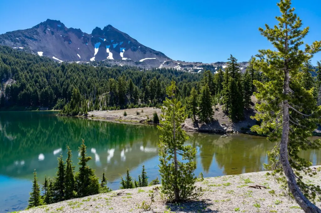 Stunning mountain views from the Green Lakes Trail in Deschutes National Forest, Oregon
The culmination of the hike is nothing short of spectacular. You emerge into a vast meadowed valley, nestled between the towering peaks of South Sister and Broken Top. Here, you find three pristine lakes reflecting the dramatic landscape.
This is a popular trail, especially given its beauty and relative ease. On a weekday morning in July, we arrived at 7:30 am and the parking lot was already busy. For a weekend hike, aim to be at the trailhead, about a 45-minute drive from Bend, no later than 8:00 am to ensure a parking spot.
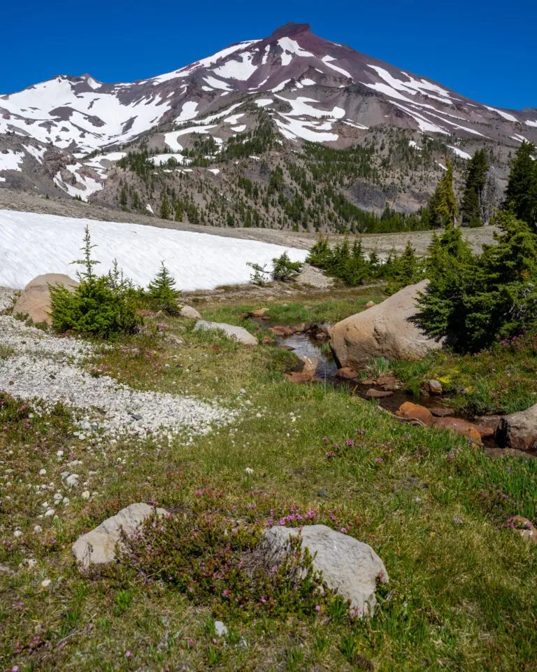 View of Broken Top mountain from the Green Lakes Trail
The Moraine Lake Trail
- Length: 5.2 miles
- Elevation Gain: 1,500 ft.
- Trail Type: Out and Back (with lollipop option)
- Difficulty: Moderate
- Pass Required? Northwest Forest Pass or America the Beautiful Pass
- Dog-Friendly? Yes, on a leash
- Trailhead Location: Devils Lake / South Sister Trailhead
- Wilderness Permit: Required June 15th – October 15th
Another stunning hike off the Cascade Lakes Scenic Byway, the Moraine Lake Trail offers incredible mountain views with a moderate effort. This trailhead is shared with the demanding South Sister summit route, meaning it sees significant traffic. We arrived before 7 am to secure a spot and get an early start, which we highly recommend during peak season.
The first 1.7 miles climb steadily through the forest. The payoff arrives as you emerge into a beautiful basin at the base of South Sister and Broken Top. The views here are expansive and awe-inspiring.
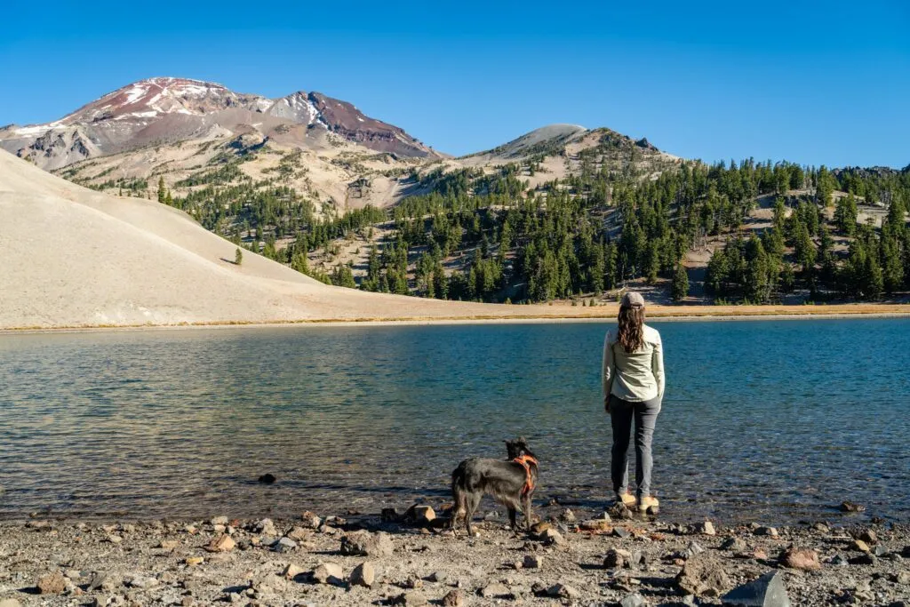 Relaxing by the clear waters of Moraine Lake at the base of South Sister peak
Moraine Lake itself sits right at the foot of South Sister, its cool, clear waters offering fantastic reflections of the peak. The hike can be extended into a small lollipop loop by heading left just before the lake to gain the ridge above, offering even more spectacular views of the surrounding mountains.
This hike is an excellent option for a day trip and is also a popular, relatively accessible spot for an overnight backpacking trip. It provides a taste of the Three Sisters Wilderness without the extreme difficulty of summiting. Remember, a Central Cascades Wilderness Permit is mandatory for this specific trailhead during the permit season (mid-June to mid-October), which is also the prime time to access the area due to snow.
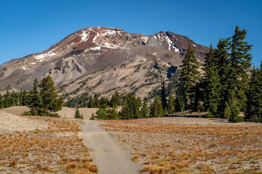 Impressive view of The South Sister peak from the Moraine Lake trail
The Tom, Dick, and Harry Mountain Trail (Mount Hood National Forest)
- Length: 9 miles
- Elevation Gain: 1,700 ft.
- Trail Type: Out and Back
- Difficulty: Moderate / Hard
- Pass Required? Northwest Forest Pass or America the Beautiful Pass
- Dog-Friendly? Yes, on a leash
- Trailhead Location: Mirror Lake Trailhead
While we’ve already highlighted McNeil Point, Tom, Dick, and Harry Mountain offers a slightly more accessible, yet still challenging, Mount Hood hiking experience. Sharing a busy trailhead right off US-26, parking here requires an early start.
The initial section to Mirror Lake is relatively flat and easy, popular with families. The real climb begins after the lake, ascending over 1,000 feet to the ridge.
Once on the ridge, the trail traverses across the landscape, offering ever-changing perspectives of Mount Hood across the valley. On a clear day, you can also see other Cascade peaks like Mount Adams and Mount Jefferson. The upper section includes traversing some boulder fields, requiring careful footing. Sturdy footwear and a reliable map (like AllTrails) are highly recommended.
The Misery Ridge Trail (Smith Rock State Park)
- Length: 6 miles
- Elevation Gain: 1,700 ft.
- Trail Type: Loop
- Difficulty: Moderate / Hard
- Pass Required? Oregon State Parks Pass
- Dog-Friendly? Yes, on a leash
- Trailhead Location: Canyon Trail Trailhead
The Misery Ridge Trail lives up to its name, at least for the initial climb! The first third of a mile gains 700 feet rapidly, a stiff challenge that gets the heart pounding. However, this hike is a spectacular reminder of Oregon’s diverse geography. Cross the Cascades, and the landscape transforms into the high desert, dramatic and unique.
Smith Rock State Park’s rock formations feel more akin to Utah or Arizona than the lush Pacific Northwest stereotype. Once you conquer the initial ascent and reach the ridge, the panoramic views are truly spectacular.
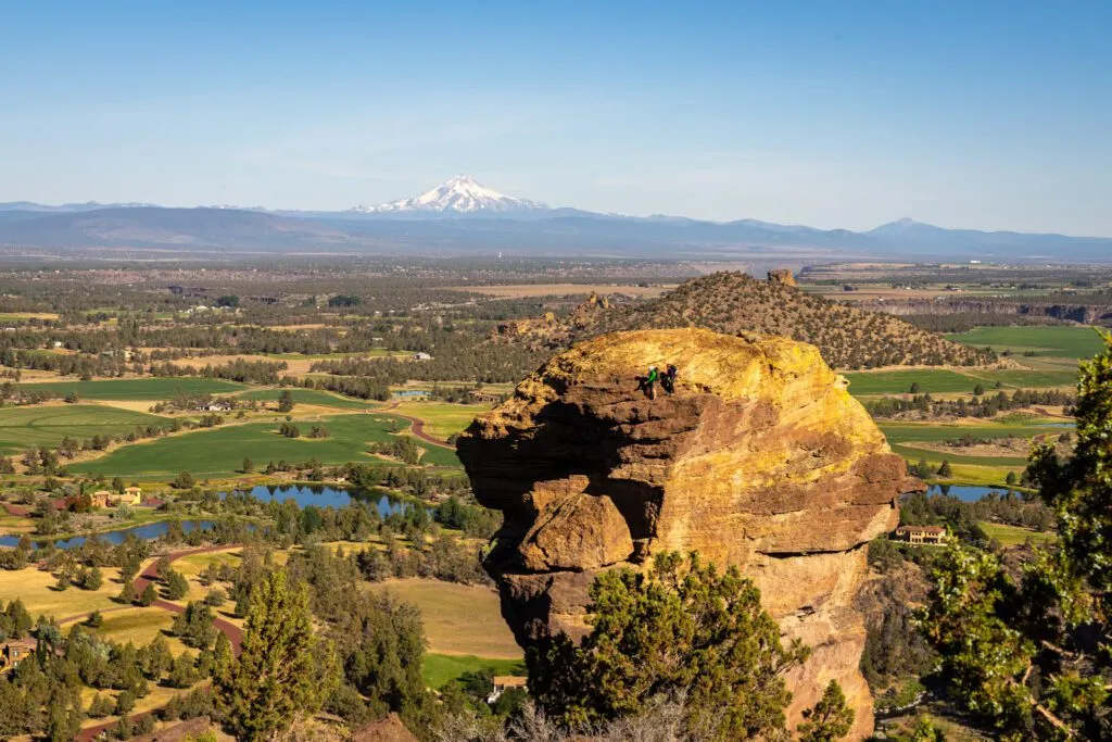 Dramatic high desert landscape seen from the Misery Ridge Trail at Smith Rock State Park
The trail wraps around, bringing you face-to-face with Monkey Face, an iconic rock climbing destination aptly named for its profile. You’re likely to see climbers scaling its walls. From the highest point, a steep set of switchbacks descends back to the river level.
There are different options to complete the loop. We recommend taking the Summit Trail route on the return section after descending from Monkey Face, as it offers better views than the flat river trail. This hike is best done early in the day, especially in summer, to avoid the heat. Bring plenty of water and be aware of the possibility of rattlesnakes – we encountered one here, a first for us! Watch where you place your hands and feet and give wildlife plenty of space.
The Tamanawas Falls Trail (Mount Hood National Forest)
- Length: 3.4 miles
- Elevation Gain: 600 ft.
- Trail Type: Out and Back
- Difficulty: Easy / Moderate
- Pass Required? Northwest Forest Pass OR America the Beautiful Pass OR $5 Day Use Fee
- Dog-Friendly? Yes, on a leash
- Trailhead Location: Tamanawas Falls Trailhead
Oregon is famed for its waterfalls, and Tamanawas Falls near Mount Hood deserves a spot on any waterfall enthusiast’s Oregon hiking trip itinerary. This trail blew us away on our first visit and remains a favorite, offering a fantastic payoff for moderate effort.
The trailhead is conveniently located off Highway 26. Parking is limited, and unofficial parking along the highway is prohibited and ticketed, so arrive early to secure a spot in the designated lot.
The hike begins by crossing a footbridge over the river, then leads into a pleasant forest walk alongside a creek. The sound of the water accompanies you for most of the journey.
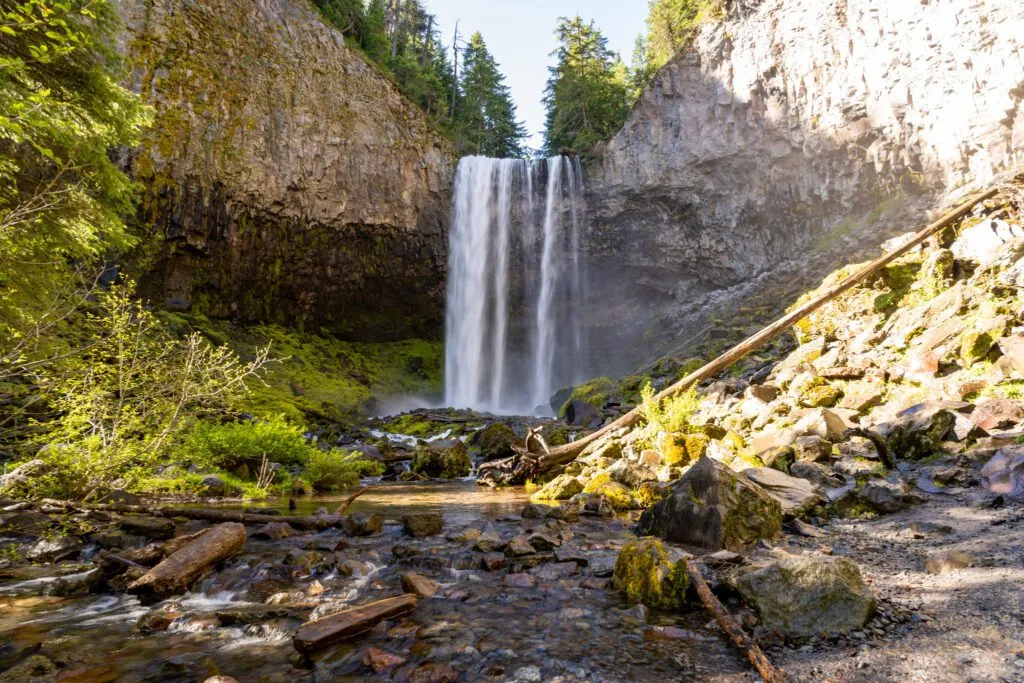 Tall, curtain-like Tamanawas Falls cascades down rocky cliffs in Mount Hood National Forest
There’s one challenging section just before the falls – a steep, rocky, and often slippery stretch lasting less than a quarter mile. Take it slow and wear shoes with good traction. The effort is well worth it for the view of Tamanawas Falls cascading 110 feet over a rocky cliff face. The mist at the base is refreshing in summer but can make photos tricky!
The Saddle Mountain Trail (Saddle Mountain State Natural Area)
- Length: 4.8 miles
- Elevation Gain: 1,800 ft.
- Trail Type: Out and Back
- Difficulty: Moderate / Hard
- Pass Required? None
- Dog-Friendly? Yes, on a leash (cautionary note below)
- Trailhead Location: Saddle Mountain Trailhead
This hike had been on our Oregon hiking trip wish list for years, often closed for repairs. When it finally reopened, we immediately headed out, only to be met with thick coastal fog at the trailhead! We decided to go for it anyway, hoping it would clear – and it did, rewarding us with absolutely spectacular, far-reaching views.
The hike is split into two distinct parts regarding difficulty. The first two-thirds are firmly moderate. However, after reaching a viewpoint facing south, the trail becomes significantly harder.
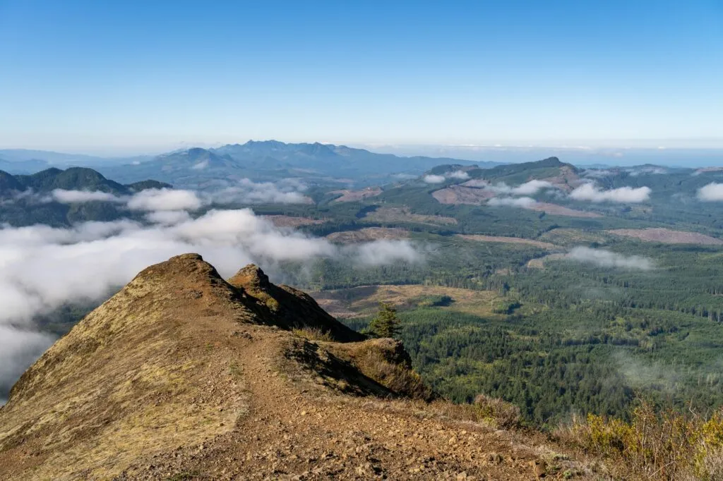 Sweeping views of the Oregon Coast and distant mountains from Saddle Mountain
The final section to the peak is steep and rocky, though a metal mesh has been installed in parts to aid traction. This last quarter mile demands effort but delivers incredible vistas of the Pacific Ocean, the Columbia River mouth, and distant Cascade peaks like Mount Rainier (on a clear day), Mount St. Helens, Mount Adams, and Mount Hood. Be cautious on the descent, as slipping is possible.
Located off Highway 26 en route to Cannon Beach, this hike makes an excellent start to an Oregon Coast day trip from Portland. Important note for dog owners: A section of the upper trail is covered with chain-link fencing. While our dog wasn’t injured, she found it uncomfortable, and it could be difficult for some dogs. Consider this if bringing your pet.
The Ramona Falls Trail
- Length: 7.1 miles
- Elevation Gain: 1,000 ft.
- Trail Type: Lollipop
- Difficulty: Easy / Moderate
- Pass Required? Northwest Forest Pass or America the Beautiful Pass
- Dog-Friendly? Yes, on a leash
- Trailhead Location: Ramona Falls Trailhead
Another gorgeous waterfall hike in Mount Hood National Forest, Ramona Falls is accessed via a trail whose length keeps some crowds away, making it a slightly more peaceful option for your Oregon hiking trip. The trail itself is not overly difficult, and the scenery after crossing the Sandy River is stunning.
The most challenging aspect of this hike can be the Sandy River crossing. There is no longer a seasonal bridge installed by the Forest Service, meaning you need to find your own safe way across the river. This can be particularly tricky and potentially dangerous when the water is high.
The trail is a lollipop loop. The first mile is a relatively flat walk to the river. Once across, the trail forks. Both directions lead to Ramona Falls, and the choice doesn’t significantly impact the scenery.
Ramona Falls is a striking 120-foot waterfall where countless individual rivulets cascade over mossy, columnar rock formations. It’s a unique and beautiful sight. Complete the loop, navigate the river crossing again, and head back to the trailhead, carrying the memory of this impressive cascade.
The John Dellenback Dunes Trail (Oregon Coast)
- Length: 5.5 miles
- Elevation Gain: 308 ft.
- Trail Type: Out and Back
- Difficulty: Easy
- Pass Required? Northwest Forest Pass or America the Beautiful Pass
- Dog-Friendly? Yes, on a leash
- Trailhead Location: John Dellenback Dunes Trailhead
This unique hike on the southern Oregon Coast takes you through diverse ecosystems, culminating at a secluded sandy beach accessible only by foot. It’s a fascinating deviation from typical coastal hikes.
The trail starts on a well-defined sandy path before opening up onto the vast Oregon Dunes. The scale of the dunes is impressive, and discovering patches of forest and wildflowers somehow surviving in the sandy expanse is quite striking.
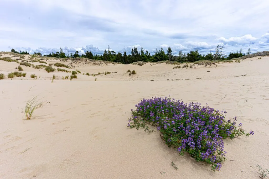 Unexpected wildflowers thriving in the sandy landscape of the Oregon Dunes trail
Hiking on the dunes is slower and more challenging than on packed earth, and yes, your shoes will fill with sand! High-top hiking boots help keep sand out. The trail is also harder to follow here, so a reliable map or hiking app (like AllTrails Pro with offline maps) is essential.
After traversing the dunes, you briefly enter a sandy forest before emerging onto a beautiful, quiet beach. This is a great reward after the sandy trek and a perfect spot for a peaceful break before heading back.
Cascade Head (Oregon Coast)
- Length: 4.2 miles
- Elevation Gain: 1,100 ft.
- Trail Type: Out and Back
- Difficulty: Moderate
- Pass Required? None (from the lower trailhead)
- Dog-Friendly? No
- Trailhead Location: Cascade Head Nature Preserve
For years, this stunning coastal hike was closed whenever we looked to visit. We finally hiked it during winter, experiencing its dramatic beauty even under stormy skies. While there’s an upper trailhead offering a shorter hike, the more rewarding experience is from the lower south trailhead.
The hike begins with a walk along the road before joining a path and boardwalk, entering a dense, fern-filled forest. This magical sitka spruce forest is a signature of Pacific Northwest coastal hiking.
The trail then climbs steadily through the forest, eventually emerging onto the grassy slopes of Cascade Head. Here, you’re greeted with magnificent, expansive views south and west along the Oregon Coast.
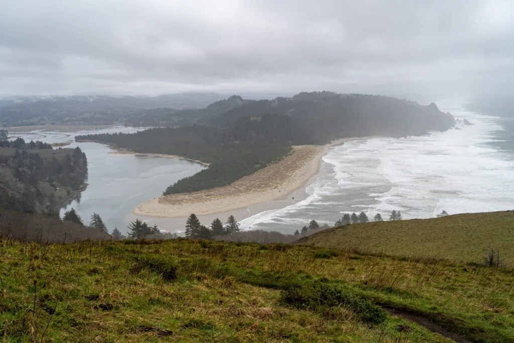 Coastal cliffs and stormy skies at Cascade Head on the Oregon Coast
Be prepared for wind as you exit the shelter of the trees! The trail continues to climb steeply to an even higher viewpoint, where the lower and upper trails converge. This final ascent is a bit of a push but offers the most commanding views. This trail is managed by the Nature Conservancy, and dogs are not permitted to protect the sensitive habitat, including the Tule elk that frequent the area. Keep an eye out for them in the fields near the start!
Mount Scott (Crater Lake National Park)
- Length: 4.2 miles
- Elevation Gain: 1,300 ft.
- Trail Type: Out and Back
- Difficulty: Moderate
- Pass Required? America the Beautiful Pass (or Crater Lake Entry Fee)
- Dog-Friendly? No
- Trailhead Location: Mount Scott Trailhead
Reach the highest accessible point in Crater Lake National Park with this moderate hike up Mount Scott. Located on the eastern side of the caldera, the trail leads to an old fire lookout offering unparalleled views over the impossibly blue Crater Lake and the distant peaks like Mt. Thielsen and Mt. McLoughlin.
The hike is a steady climb with switchbacks, and the view of Crater Lake improves with every foot of elevation gained. The deep color of the water is mesmerizing from this vantage point.
Important Note: The road to the Mount Scott trailhead is closed in winter. Access is typically seasonal. You can hike to the trailhead from a parking area outside the closed gate in the late spring/early summer, adding distance but allowing earlier access if the road hasn’t fully opened. Always check current road conditions on the official Crater Lake National Park website before planning your visit. As with all trails in Crater Lake National Park, dogs are not allowed.
God’s Thumb (Oregon Coast)
- Length: 4.3 miles
- Elevation Gain: 1,100 ft.
- Trail Type: Out and Back
- Difficulty: Easy / Moderate
- Pass Required? Northwest Forest Pass or America the Beautiful Pass
- Dog-Friendly? Yes, on a leash
- Trailhead Location: The Knoll Open Space Trailhead
Be warned: this hike near Lincoln City can get extremely muddy, especially after rain, which is frequent on the coast. Check recent trail reports before you go and wear appropriate footwear – save those pristine white sneakers for another day!
The hike leads through a forested area, passing The Knoll, a viewpoint offering lovely vistas of the Oregon Coast, before emerging onto the bluff overlooking the ocean.
The final ascent to the unique land formation known as God’s Thumb is steep and narrow but generally manageable. Stick to the established path and take your time. It will likely be windy at the top, so bring a windbreaker. Note that the trail section right up to the Thumb can become very slippery when muddy; if conditions are poor, it’s safer to enjoy the view from the base.
Honorable Mentions: More Oregon Hiking Options
Oregon’s trail network is vast! Here are a few more hikes that narrowly missed our top list but are still fantastic options for your Oregon hiking trip.
- Zig Zag Mountain from Timberline Lodge (Mount Hood): A relatively easy hike offering stunning views of Mount Hood and the rugged Zig Zag Canyon. It follows sections of the Pacific Crest Trail and Timberline Trail.
- Ecola State Park (Oregon Coast): Near Cannon Beach, this park offers beautiful coastal trails like the hike to Indian Beach and the trail down to Crescent Beach. Combine them for a great day trip, but arrive early as the parking lot is small and popular.
- Cleetwood Cove (Crater Lake): This is the only official trail allowing access to the water level of Crater Lake. The payoff (getting to the lake!) is fantastic, but the hike itself is a steep, strenuous descent followed by an equally tough climb back up at high elevation. Not for the faint of heart or knee!
- Wahclella Falls (Columbia River Gorge): A short, sweet hike leading to a beautiful waterfall in the Gorge. It’s a popular spot for a reason, and the smaller parking lot helps manage crowds slightly.
On Our Oregon Hiking Trip Bucket List
Our exploration of Oregon is far from over! Here are a few incredible-sounding hikes across the state that are currently on our personal bucket list:
- Paradise Park (Mount Hood): An extension of the Zig Zag Canyon area, leading to a beautiful meadow at the base of Mount Hood, known for its wildflowers. We’re eager to hike this once the snow melts.
- Broken Top / No Name Lake (Central Oregon): Famous for its dramatic volcanic scenery. Accessing the trailhead often requires a high-clearance vehicle or a longer hike from a different starting point like the Tam McArthur Rim Trail. We had a trip planned but got snowed out – it’s high on the list for a future visit!
- Wallowa Lake / Eagle Cap Wilderness (Northeastern Oregon): A remote and stunning wilderness area requiring backpacking to experience fully. The Wallowa River Loop Trail is a prime target for when we can tackle an overnight trip here.
- The Strawberry Mountain Wilderness (Eastern Oregon): Located further east, this area offers beautiful mountain landscapes and diverse trails, a great destination for a multi-day exploration trip.
Planning Your Oregon Hiking Trip: Frequently Asked Questions (FAQ)
Got questions about planning your hiking adventures in Oregon? Here are some common ones.
What types of passes do I need for hiking in Oregon?
You’ll likely need either a Northwest Forest Pass (for National Forests), an America the Beautiful Pass (covers all federal lands), or an Oregon State Parks Pass (for state parks). Always check the specific requirements for the trailhead you plan to visit.
Are dogs allowed on Oregon hiking trails?
Many trails are dog-friendly, but they must be kept on a leash at all times. There are notable exceptions, including trails within Crater Lake National Park and some protected natural areas like Cascade Head, where dogs are prohibited. Always verify the rules before bringing your dog.
What is the best time of year for an Oregon hiking trip?
Summer (July to September) generally offers the best weather and snow-free trails, especially at higher elevations. Spring and Fall can be beautiful with wildflowers or fall colors, but expect more rain and potentially muddy or snowy conditions depending on elevation and location. Coastal hiking is often accessible year-round, though rain is common.
What essential gear should I pack for hiking in Oregon?
Given the variable weather, waterproof hiking boots or shoes and a rain jacket are highly recommended. Always bring plenty of water and snacks. A map or hiking app (downloaded offline) is crucial, especially for less-trafficked or confusing trails. Layering clothing is key, and don’t forget sun protection.
What do “out and back” or “lollipop” mean for trail types?
An “out and back” trail goes to a destination (like a viewpoint or waterfall) and returns along the same path. A “lollipop” trail consists of a handle (out and back section) leading to a loop section at the end, forming a shape like a lollipop.
Our Favorite Oregon Hikes, Mapped
To help you visualize where these amazing hikes are located across the state for your Oregon hiking trip, here is a map showing the approximate locations of the trailheads mentioned in this guide.
